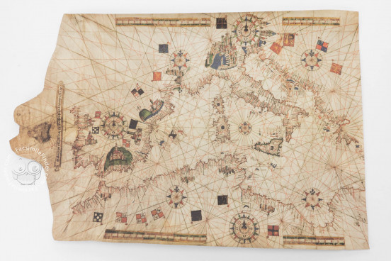
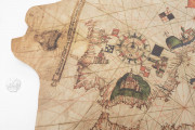
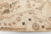
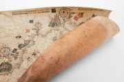
This nautical chart was made in 1533 in Palma, Majorca by the Italian mapmaker Salvatore de Pilestrina. It depicts the Mediterranean basin in a traditional way, with abundant place names. Following the tradition of late medieval Majorcan mapmaking, the chart includes a representation of the Virgin at the left edge, next to an inscription with the cartographer's signature and the date of the map.
Salvatore de Pilestrina’s life and work are barely known. There is only one other chart known certainly to have been his work. Signed and dated 1511, that chart was destroyed in World War II and is known only through a nineteenth-century copy. The Toledo chart thus provides our best witness to his work.
A Chart in the Long Tradition of Portolan Charts
The Toledo chart is a late and interesting example of early modern Majorcan nautical cartography. A representation of the Virgin seated on a cloud holding the Christ Child is included at the neck (the left narrowed edge) of the map. Under the feet of the Virgin, Pilestrina included a ribbon with an inscription indicating his authorship and the date of the chart: Salvat de Pilestrina en Mallorques en lany 1533 (Salvatore de Pilestrina in Majorca in the year 1533).
Exuberant Decoration in the "Catalan Style"
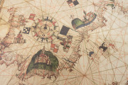
The extensive embellishment of the Toledo chart places it in the tradition of the "Catalan style," as distinguished from the more restrained "Italian style." One of the particular aspects of charts of this style is the inclusion of vignettes of inland cities, as can be seen on the Toledo chart, which contributes to the visual appeal but does nothing to inform maritime navigation.
Some European and African cities are depicted in bird's-eye-view vignettes, with flags indicating the sovereignty of each. Granada in southern Spain is one of the largest, indicated with the flag of Castile, alluding to the Siege of Granada in 1492, which ended all Islamic sovereignty on the Iberian Peninsula.
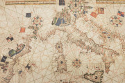
The Italian city-states of Genoa and Venice, both important Mediterranean maritime powers, are given distinctive features. The crescent-shaped harbor of Genoa with its lighthouse is clearly depicted, and the tall rectangular bell tower of Saint Mark's is recognizable in the vignette of Venice.
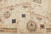
Three large compass roses are embellished with initials indicating the names of the six principal winds: Grego (northeast), Scirocco (southeast), Ostro (south), Libeccio (southwest), Ponente (west), and Maestro (northwest).
A Home in Toledo
The chart was in the collection of the Biblioteca Pública del Estado en Toledo before that library merged with the Biblioteca Regional in 1998 to form the Biblioteca de Castilla-La Mancha.
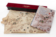
We have 1 facsimile edition of the manuscript "Portolan Chart by Salvat de Pilestrina": Carta Portulana de Salvat de Pilestrina facsimile edition, published by Millennium Liber, 2014
Request Info / Price
