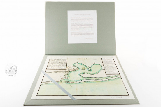
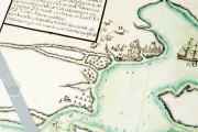
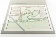
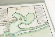
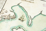
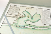
Dated 1783 and signed by José Portillo Labaca, the Mapa de Pensacola is an outstanding document for the study of one of the most important incidents of the Spanish conquest of West Florida, namely the Siege of Pensacola, which occurred in 1781. The map represents the conquest of the British settlement of Pensacola by the Spanish military leader Bernardo de Gálvez, and is a fundamental graphical testimony of that victory. Combining text and image, this map is a very clear and useful explanation of the event, describing and representing the positions of the camps, the situations of several elements, and the Spanish brigantine anchored in the bay.
This map is a perfect example of the power of the graphical representation of important historical events not only as a testimony, but also as a tool of government and propaganda, in this case for the Spanish empire.
The Map of Pensacola: A Visual Witness to American History
The Siege of Pensacola by the Spanish troops of Bernardo de Gálvez, which allowed them to control West Florida, occurred on 8th May 1781. This map was created two years later. The map is made on paper and measures 32 x 45 cm. Written in Spanish, it depicts the Bay of Pensacola in the north of the Gulf of Mexico, indicating the positions of the camps and the fortifications, the town of Pensacola, and the silhouette of the brigantine anchored to block communication between the two bays.
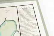
In the upper left corner, a text presents the map and explains the events depicted, while the legend in the upper right corner clarifies the different elements represented in it. The coastlines are colored in red, and most decorative elements are lacking. The practical and informative nature of this map makes it a very valuable and useful document to study not only the Siege of Pensacola, but also eighteenth-century Spanish cartography more generally.
The Siege of Pensacola: A Milestone in the History of North America
In 1776, with the proclamation of independence by the American colonies from the British Crown, a conflict began that would profoundly change American history: the War of Independence. Spain, which entered the war in 1779, fought together with the colonies against the British Army.
One of the main personalities on the Spanish side was Bernardo de Gálvez, member of a very important and well-known family, and governor of Spanish Louisiana. One of his most significant achievements was gaining control of British West Florida, by first taking Fort Bute, giving him sway over the lower Mississippi River in September of 1779, and then by assaulting Pensacola, West Florida’s capital, in May 1781.
Thanks to this assault, Gálvez gained the control of the British province of West Florida, the most important achievement by Spanish forces in the War of Independence. This map, depicting that episode, was made in Seville in 1793 by José Portillo y Labaca, whose works and life are unknown. It is held in the General Archive of Simancas (Spain) under the shelfmark MPD, 12-90.
We have 1 facsimile edition of the manuscript "Mapa de Pensacola": Mapa de Pensacola facsimile edition, published by Testimonio Compañía Editorial, 2010
Request Info / Price
