

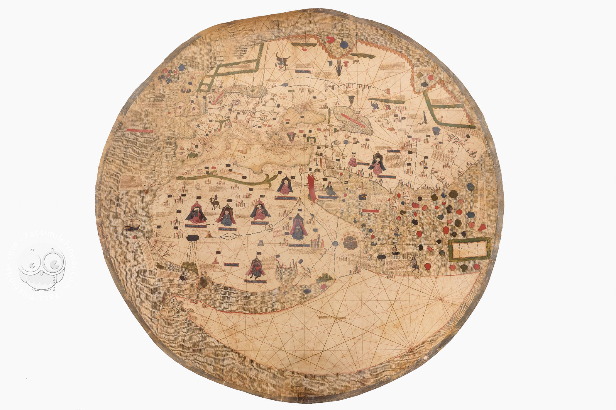
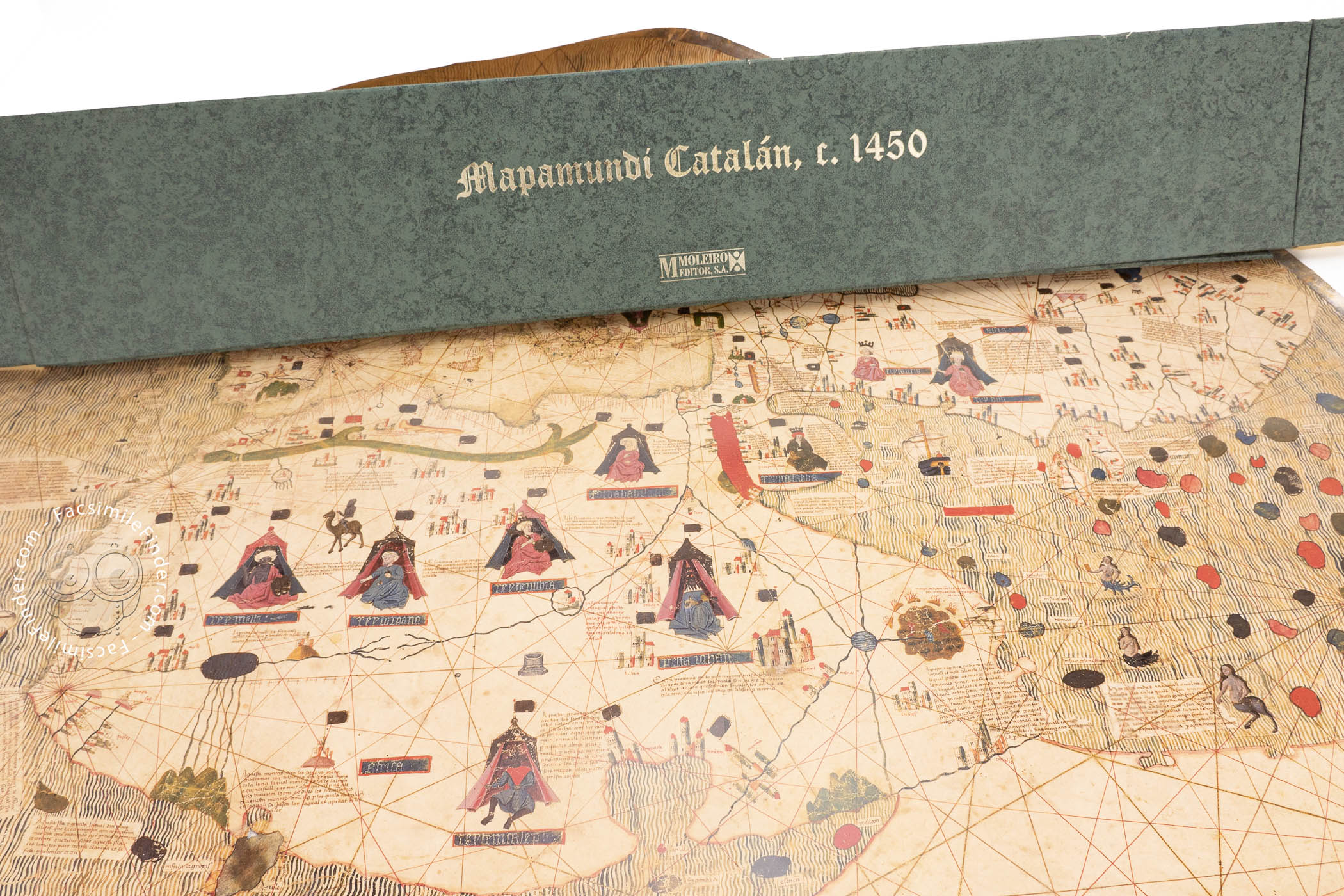
The Estense World Map depicts the continents of Africa, Europe, and Asia, surrounded by oceans, on a large circular sheet of parchment. Reflecting the Spanish tradition in mapmaking, it was created in the 1450s, perhaps on the island of Majorca. It bridges the gap between medieval mappae mundi (world maps) and early modern navigational charts, known for their detailed coastlines, rhumb lines, and accuracy. Intended as a showpiece, the map includes painted representations of people, sirens, animals, ships, and the "earthly paradise."
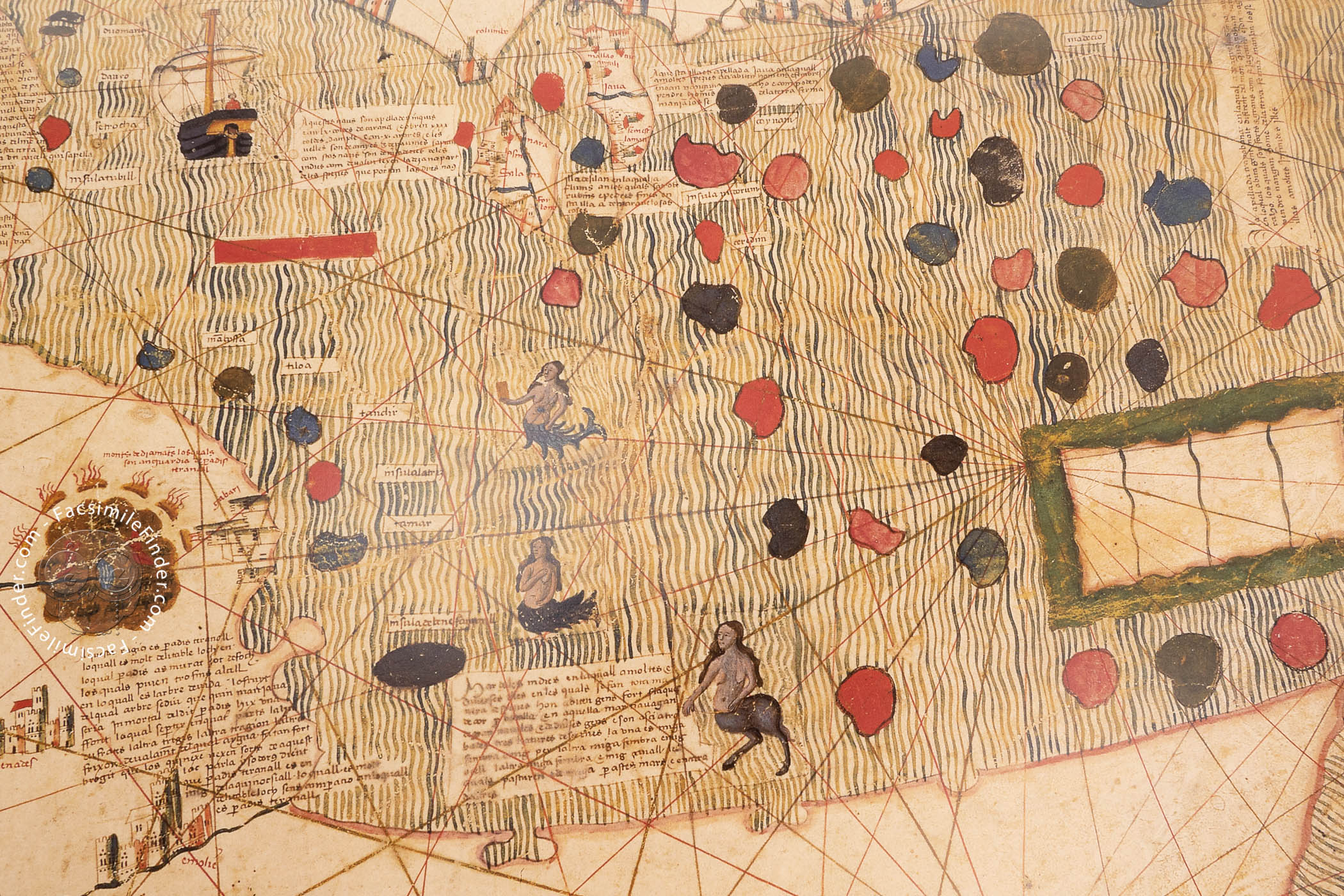
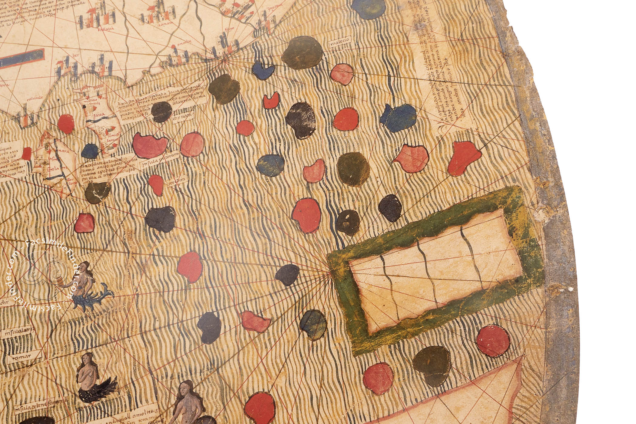
The oceans are represented as a series of undulating painted stripes of variegated green and blue coloration, except for the Red Sea, which is composed of wavy stripes of two shades of red, the color commonly found on medieval world maps.
Between Legend and Science
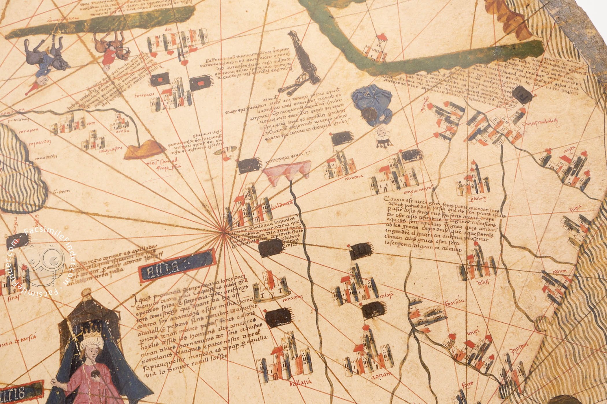
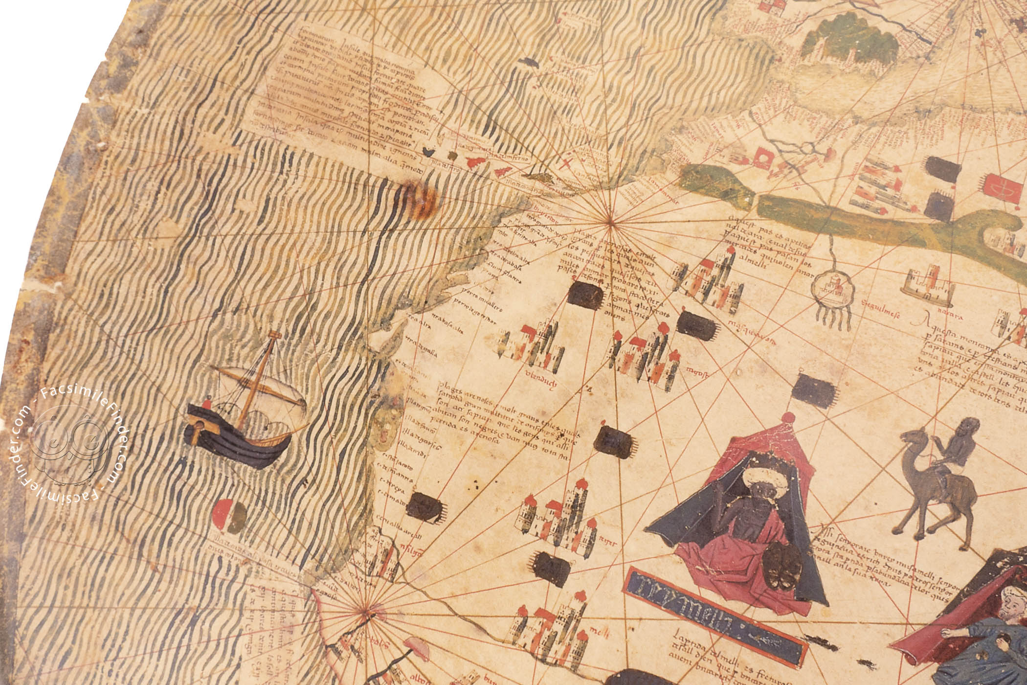
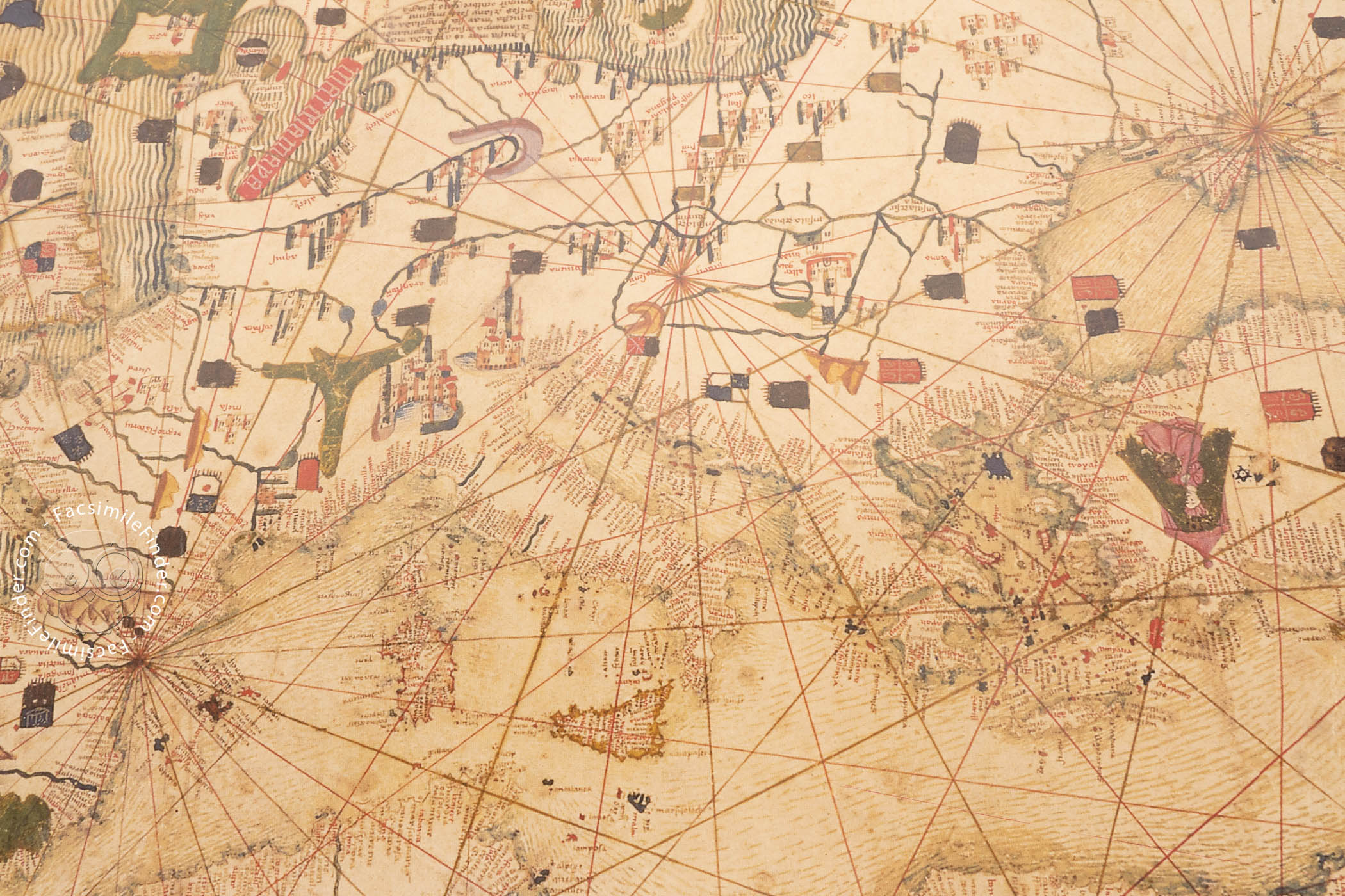
The Estense map ingeniously combines features of the medieval tradition (including details inspired by the Christian Bible and legend) with the orientation (with north at the top) and the detailed rendition of the coastline of the Mediterranean Sea seen on contemporary sailing charts. The norms for sea navigation also inform the treatment of the eastern coasts of Africa and Europe.
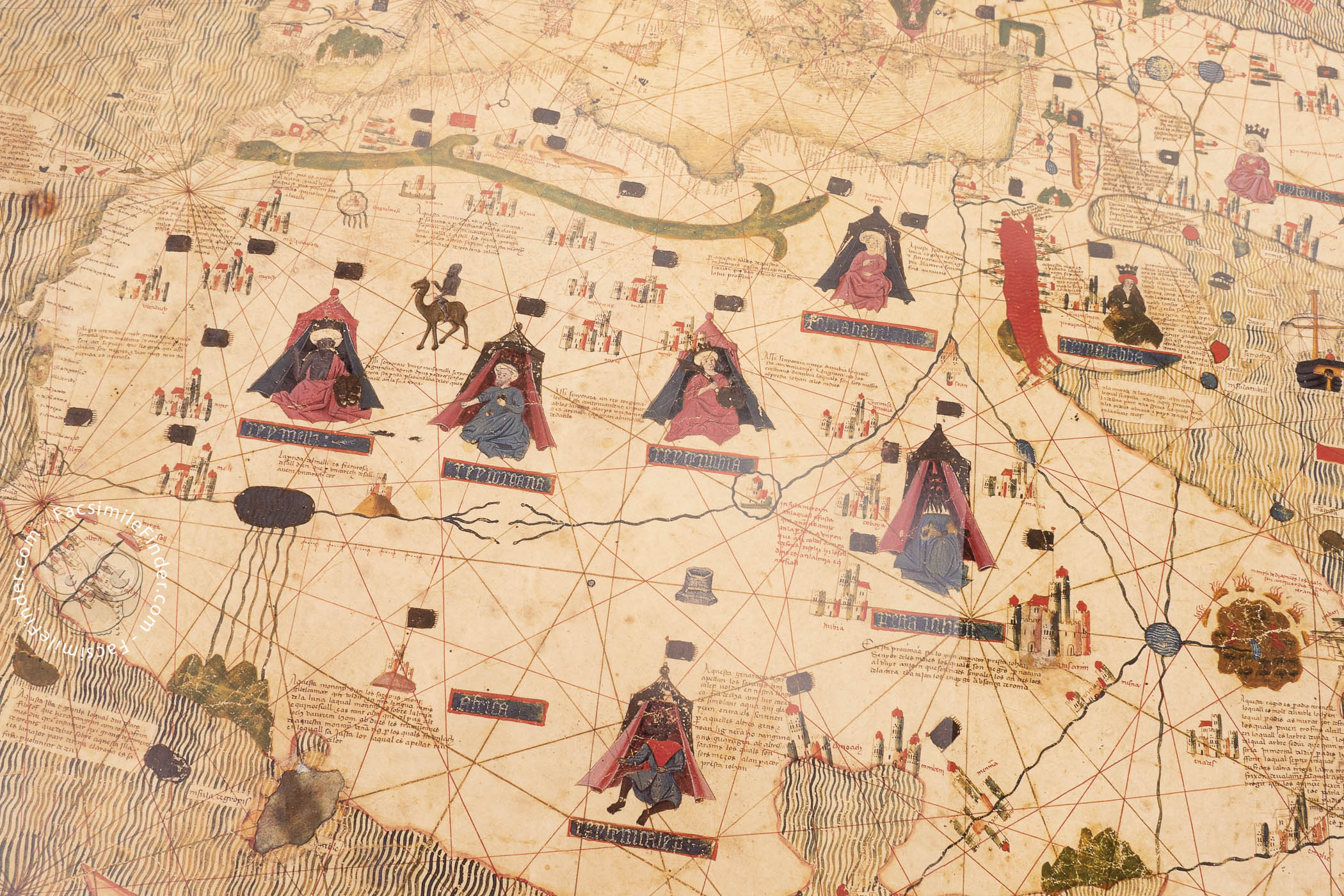
Focus on Africa
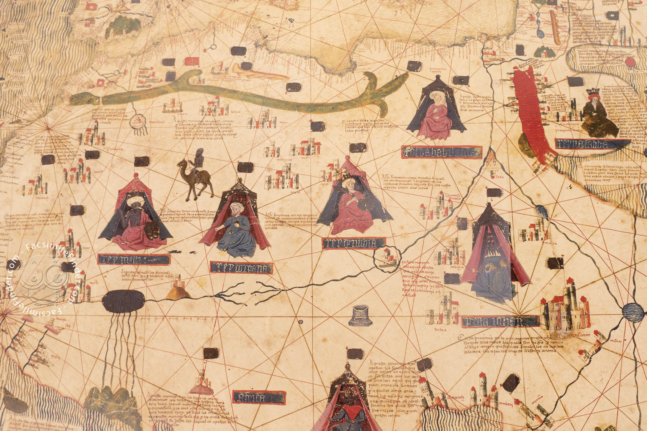
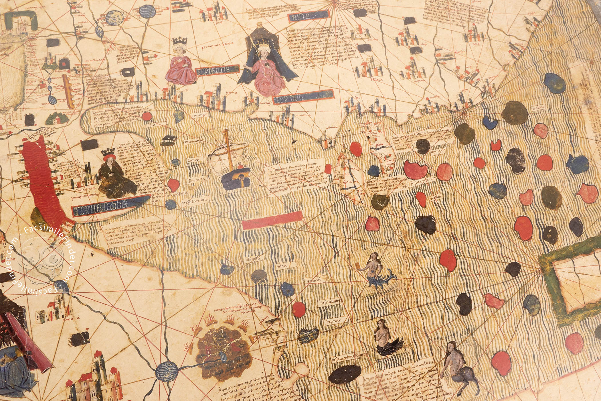
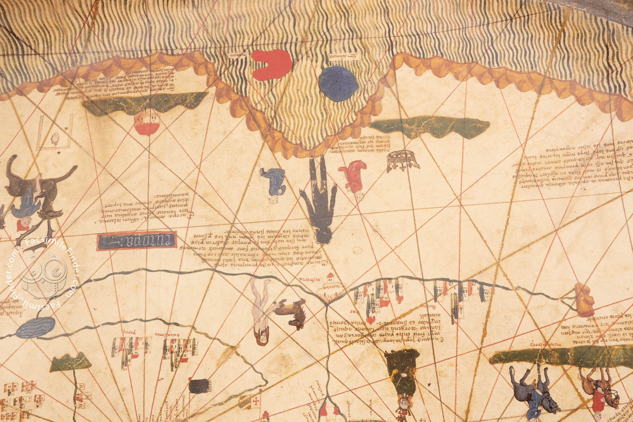
The confluence of two branches of the Nile River in North Africa—not Jerusalem of the medieval mappa mundi tradition—lies at the map's center, and the topography of the area is well defined, with the Atlas Mountains mapped in green paint. And yet, the six pictured rulers of Africa, each shown seated in front of a tent, include Prester John, a figure from medieval legend.
Reflection of Recent Discoveries
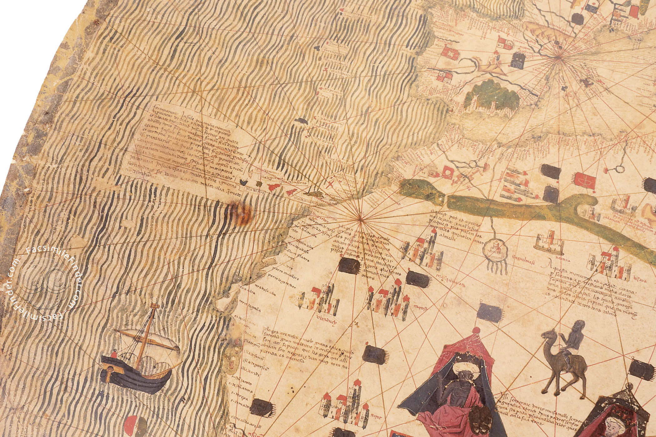
The cartographer was prudent in his depiction of Africa. Cape Verde and Cape Rosso, mapped by the Portuguese in the 1440s, are both included at the westernmost projection of the continent into the Atlantic, while the southern portion is a large triangular mass with a single inscription. The mapmaker thus avoided speculation about little explored territories.
A feature that is difficult to explain is a waterway—perhaps a canal or a river—that bisects Africa, implying a passageway between the Atlantic and Indian Oceans far north of the continent's southern tip. This feature is especially curious given the cartographer's general restraint.
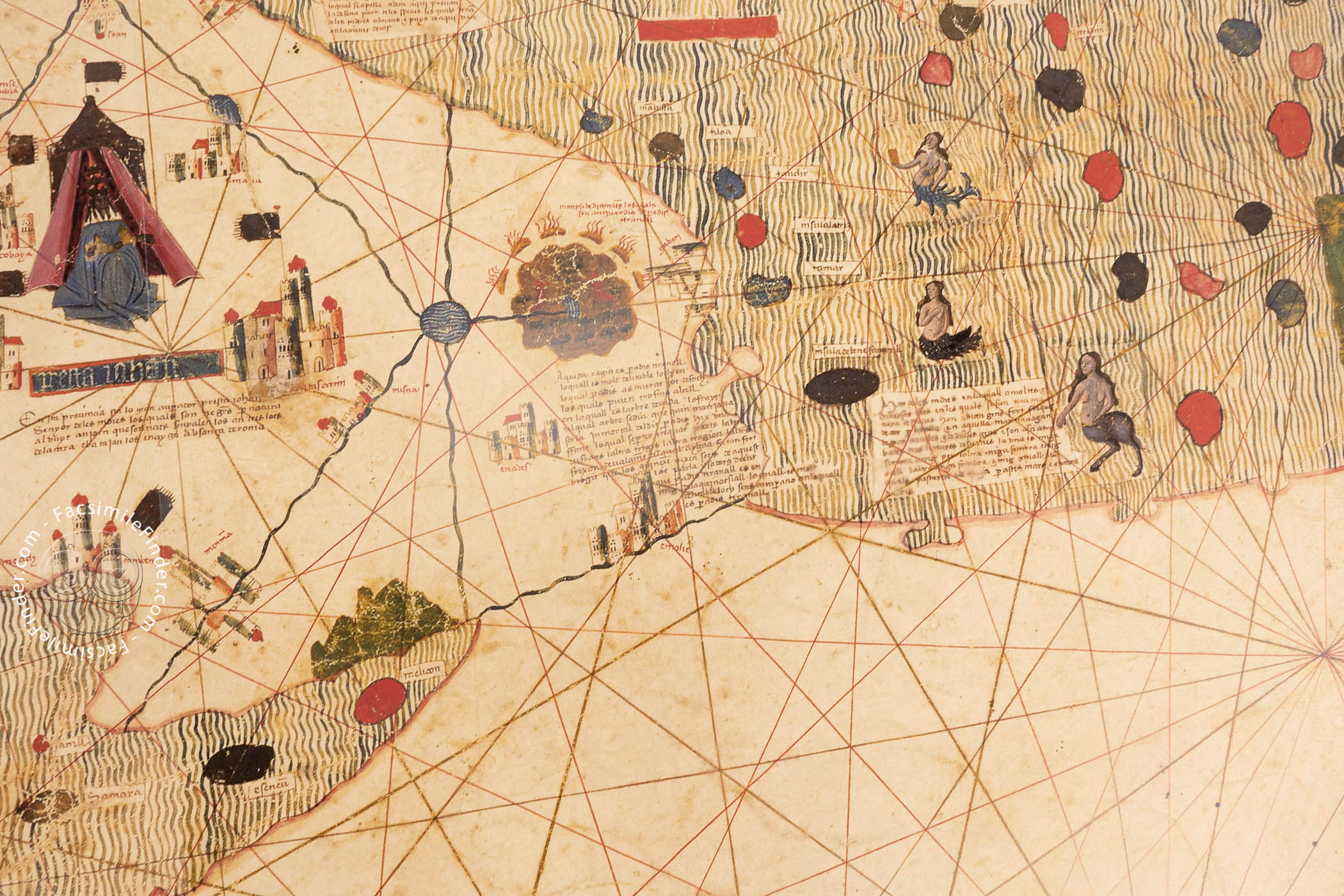
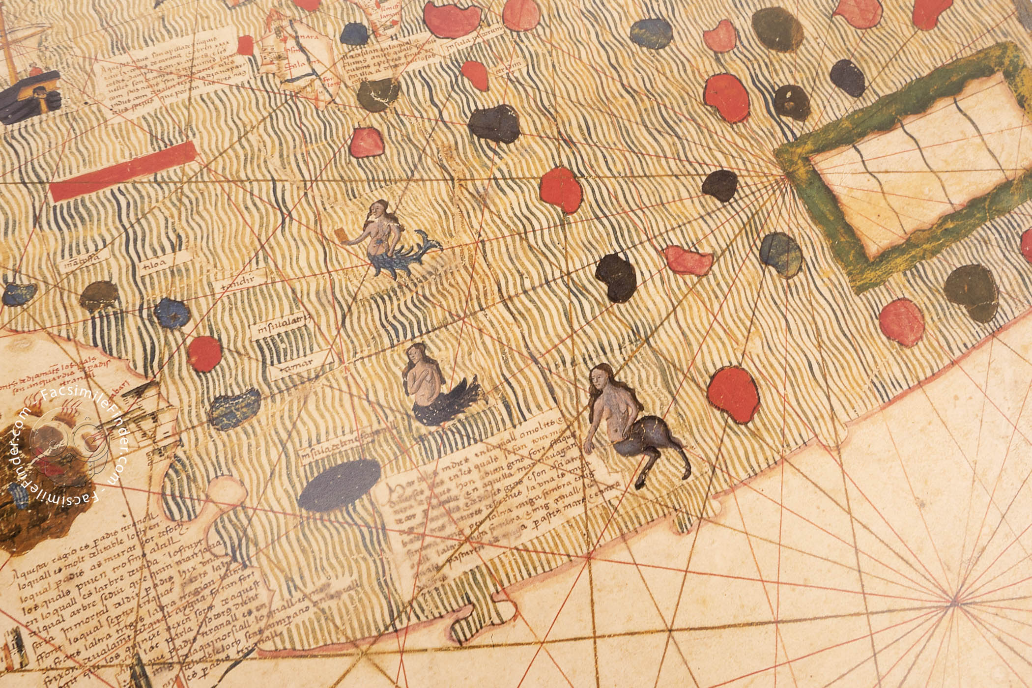
The Wild North
Although the map eschews representations of fantastic creatures in Africa, a naked man chasing a fox, two figures worshipping a nine-headed idol, a human head hanging from a gallows, and a falconer mounted on a reindeer occupy the northern realms.
Similarly, the Indian Ocean is home to three sirens, each in a different form. All have the upper body of a woman, but their lower bodies take the form of a fish, a horse, and a bird.
A Long Latin Caption
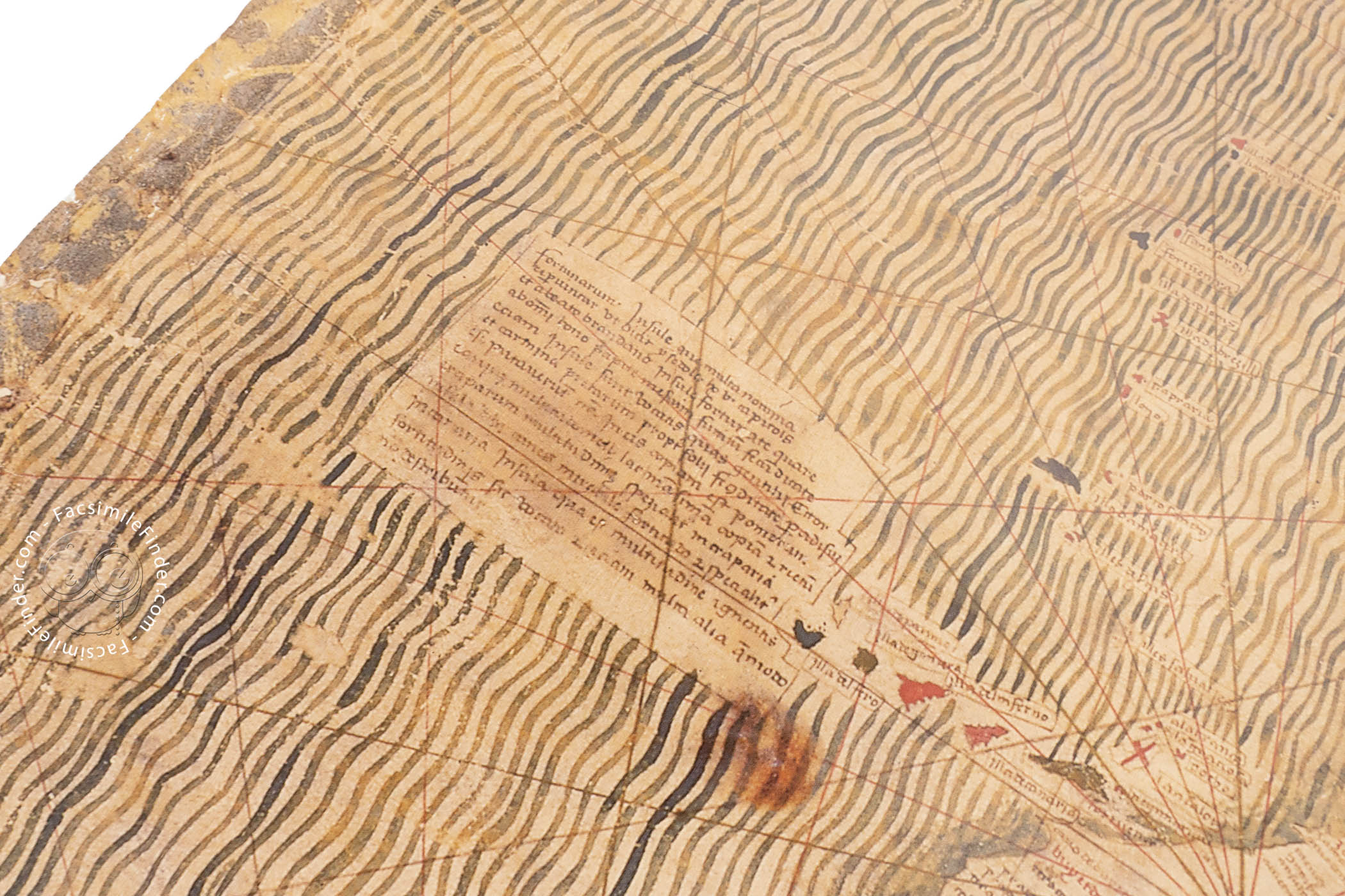
The captions and inscriptions are in Catalan, except for one. The semi-legendary Fortunate Islands, located off the Atlantic coast of North Africa, are described in a Latin-language inscription based on a text by the medieval bishop and encyclopedist Saint Isidore of Seville (d. 636).
A Showpiece Fit for a Duke
The map was in the collection of Ercole I d'Este (1431-1505), Duke of Ferrara, Modena, and Reggio. After being estranged from the d'Este library, it was donated by Giuseppe Boni in 1870 to the Biblioteca Estense, which—upon the unification of Italy in 1871—became the Biblioteca Estense Universitaria.
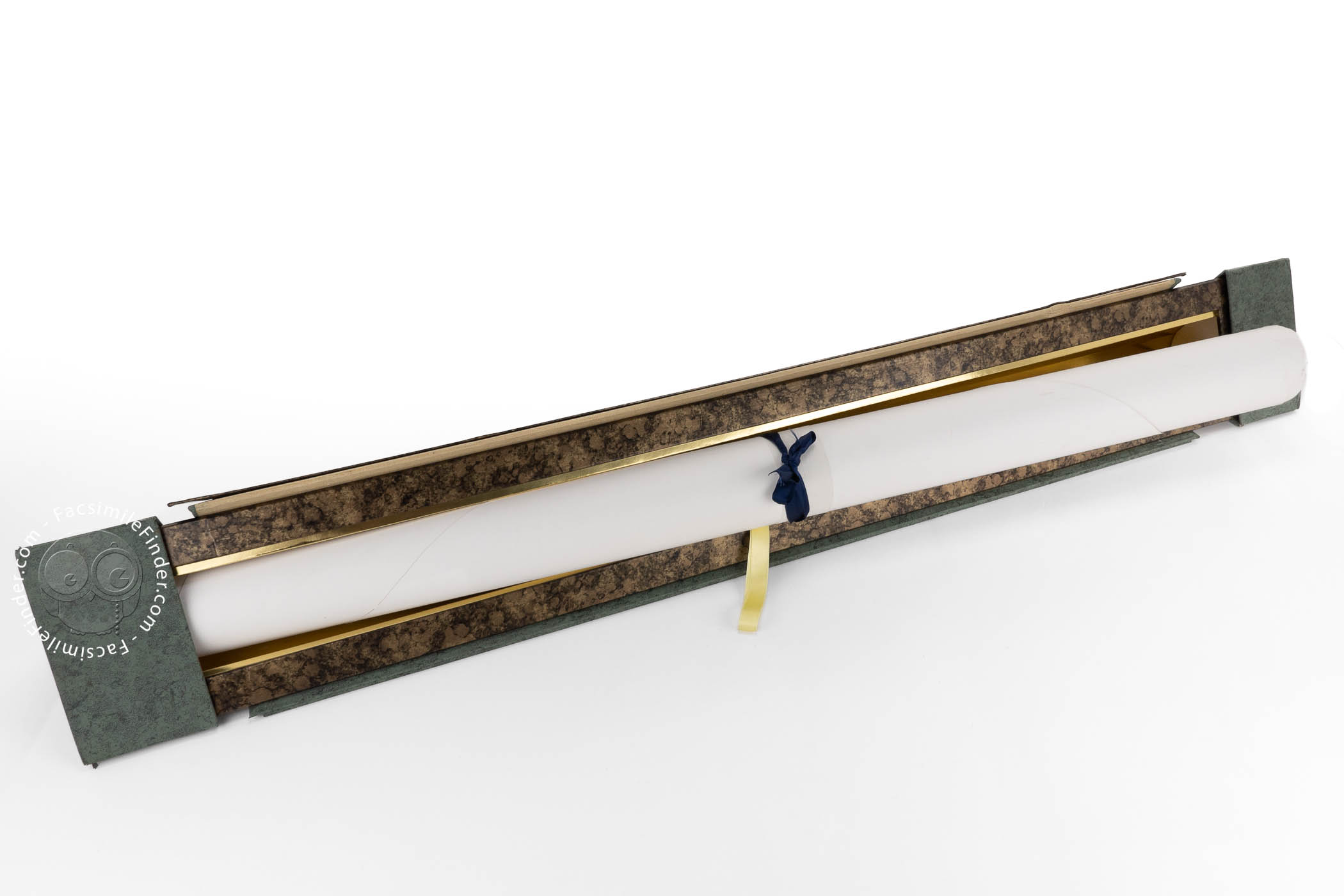
We have 1 facsimile edition of the manuscript "Estense World Map": Mapamundi Catalán Estense facsimile edition, published by M. Moleiro Editor, 1996
Request Info / Price