The Civitates Orbis Terrarum is one of the most important cartographic works of sixteenth-century Europe. Created by Georg Braun (1541–1622) and engraved mostly by Franz Hogenberg (c. 1535–1590), among others, it brings together the most realistic views of most of the cities of the known world in the sixteenth century. Its success made it one of the most famous and remarkable atlases of early modern Europe, and it is still studied and admired today for its artistic features and accuracy.
The work was first printed in Cologne in 1572, and because of its success, was reprinted several times over the years. Organized in six volumes, it shows views of almost six hundred cities all over the world, and is a fundamental source for the study of the urban landscapes in the early modern period.
An Early Modern Google Earth
The six volumes of the work measure 36 x 25 cm. The first volume was printed in Cologne in 1572, and the following ones in 1575, 1581, 1588, 1598, and 1617.
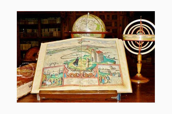
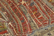
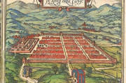
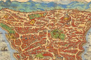
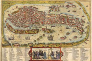
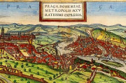
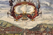
The plates, reproduced from copies of the book that are carefully hand-colored, represent cities in a remarkably accurate and realistic way. The views of the cities are accompanied by texts describing their history and notable features, creating a large and complete compendium of information, both textual and graphic.
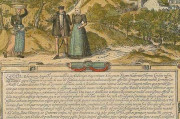
In the views of the different cities, we can see an excellent use of perspective, combining both bird’s-eye and map views to depict the places. The views of the cities are accompanied by drawings of their surrounding areas, as well as by human figures wearing clothing typical of the regions.
Thus, this work is a fundamental tool not only for studying the shape and development of the urban landscape in the sixteenth century, but also for the study of early modern fashion and traditions.
Civitates Orbis Terrarum had also a great value for contemporary readers, since it allowed them to know the world from home, and was thus a fundamental tool for armchair travelers.
The copies reproduced in this facsimile, with bright colors and great artistic quality, are held in the Historic Library of the University of Salamanca (shelfmarks BG/32146-32151) and in the National Library of Spain in Madrid (shelfmarks R/22248-250, ER/4684-46).
A Huge Success for a Great Work
The history of Civitates Orbis Terrarum is closely linked with the publication of Abraham Ortelius’ Theatrum Orbis Terrarum in 1570. Ortelius’ work, considered the first atlas in the modern sense of the word, was one of the most important cartographic works of the sixteenth century, and its commercial success inspired Georg Braun, canon of Cologne Cathedral who had worked for Ortelius in his Theatrum, to create a complete atlas of the cities of the world in 1572, assisted by Ortelius himself.
Braun coordinated a great team of artists, engravers, and informants, such as Georg Hoefnagel (1542-1600) and Franz Hogenberg (1535-1590), who made most of the plates, to create a huge, successful work organized in six volumes. The volumes were reprinted and translated several times all over Europe during the following decades.
We have 1 facsimile edition of the manuscript "Civitates Orbis Terrarum": Civitates Orbis Terrarum facsimile edition, published by CM Editores, 2015
Request Info / Price
