
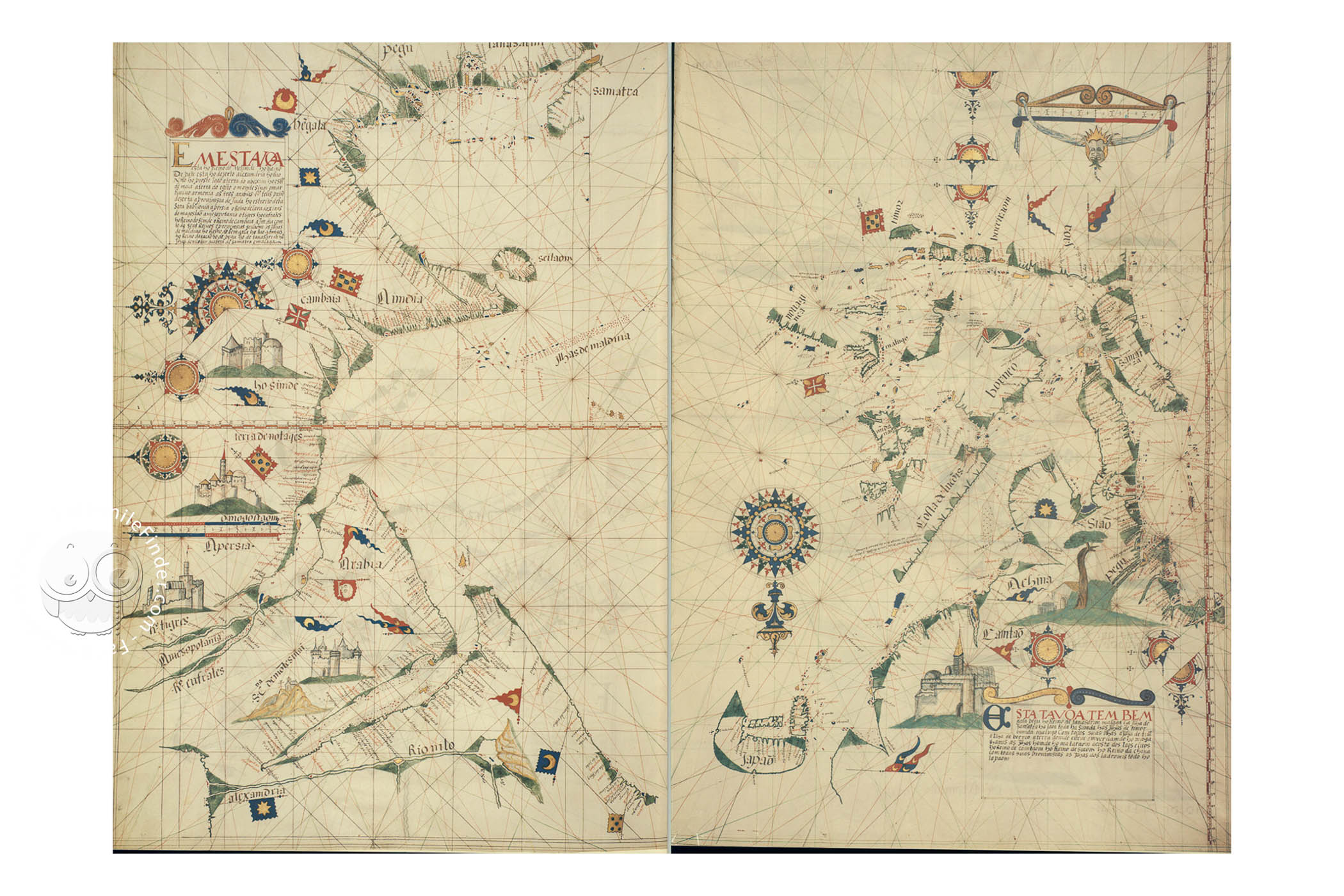
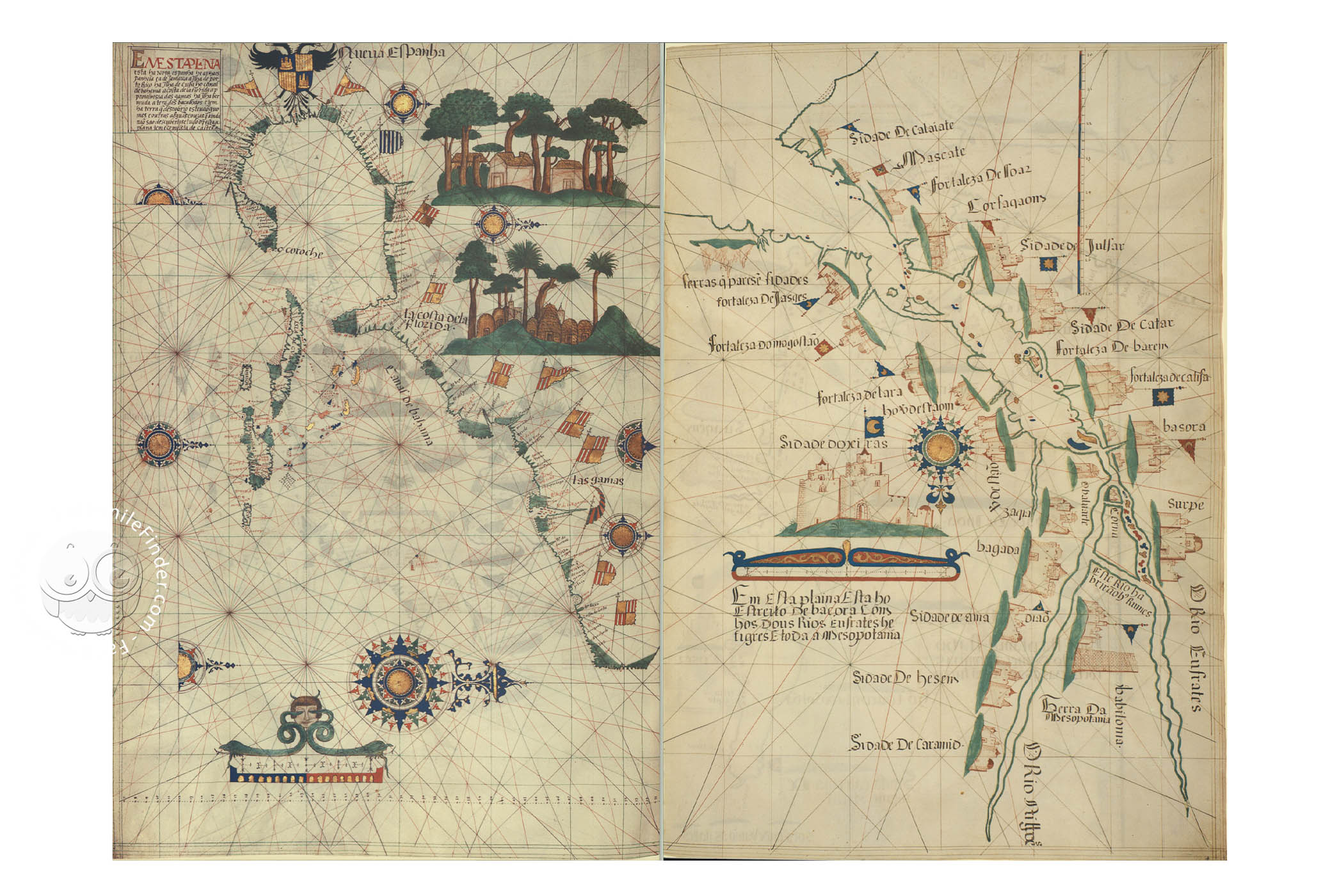
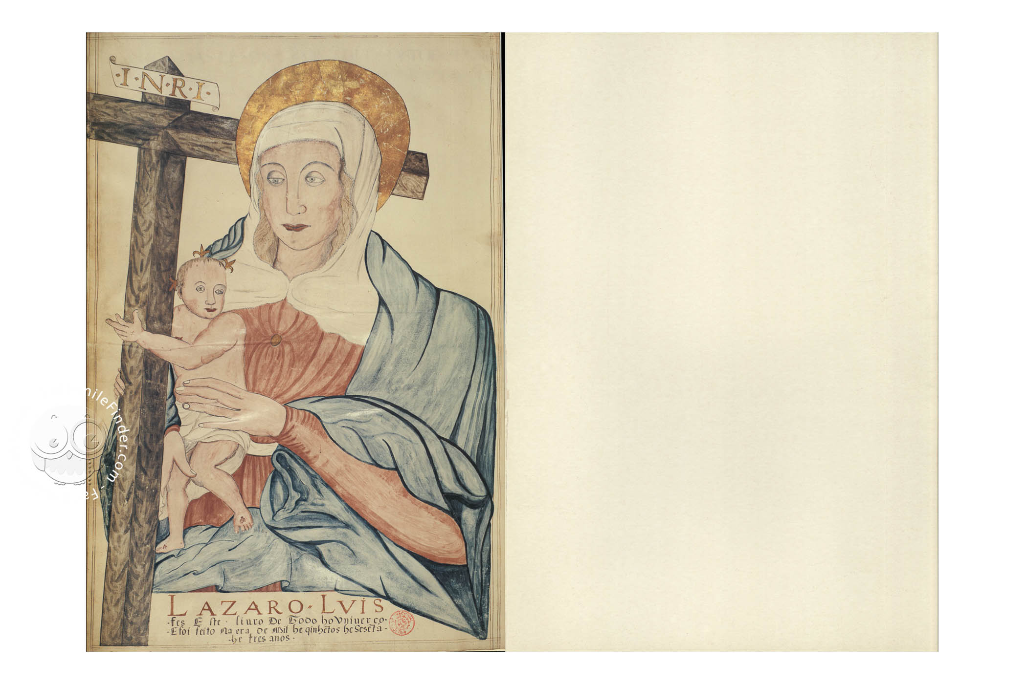
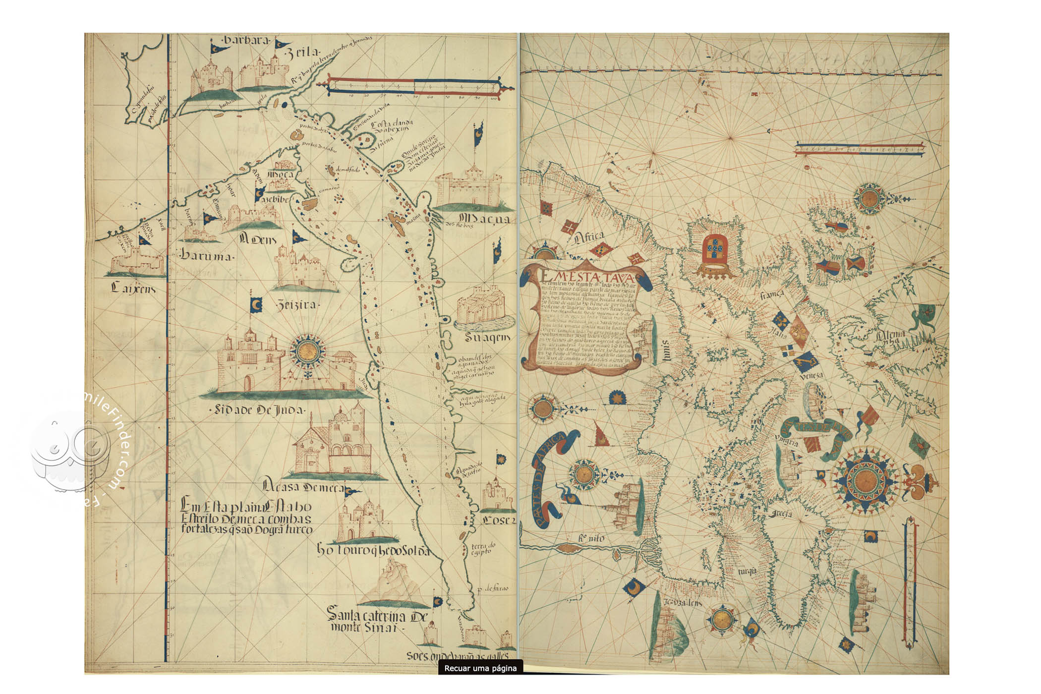
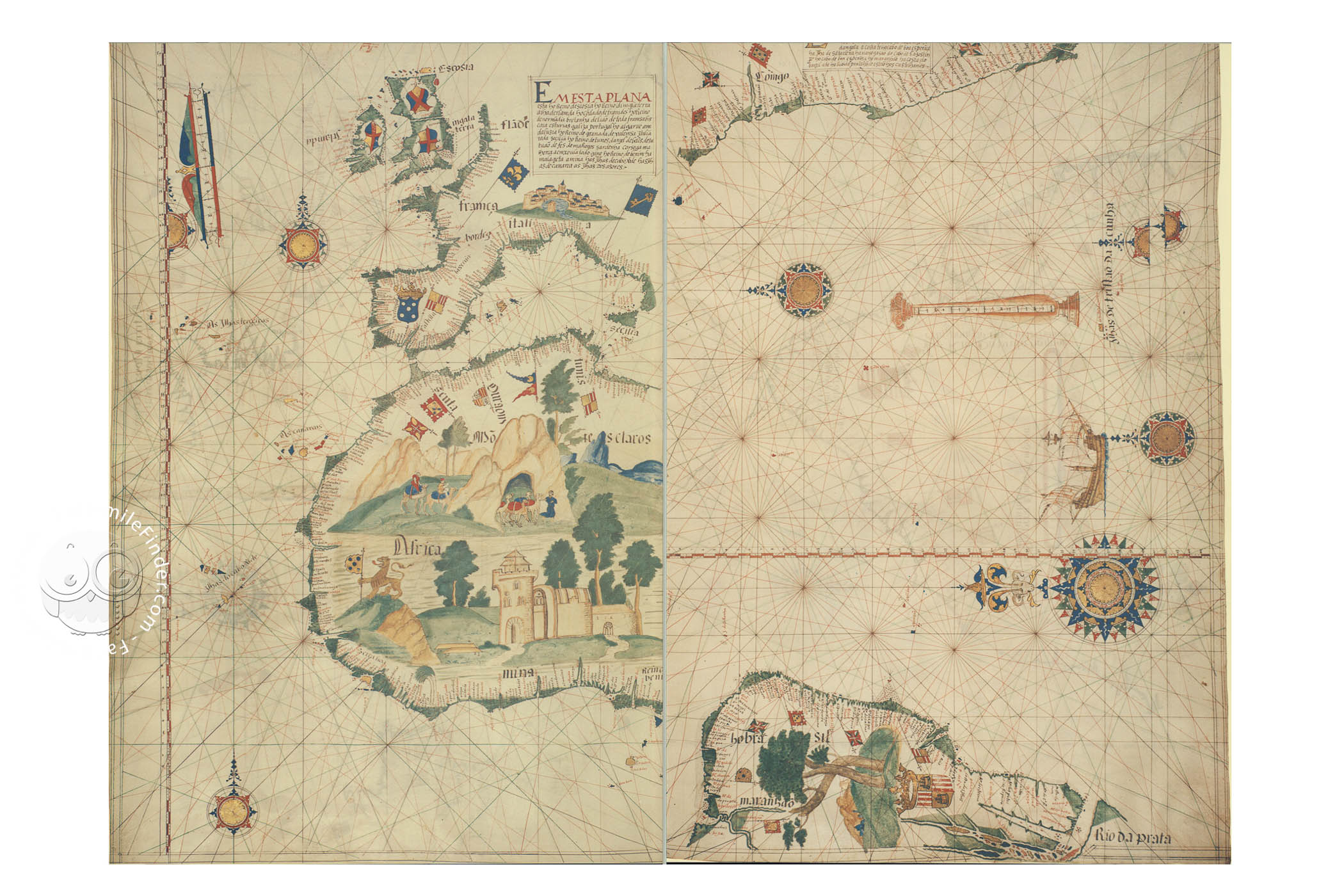
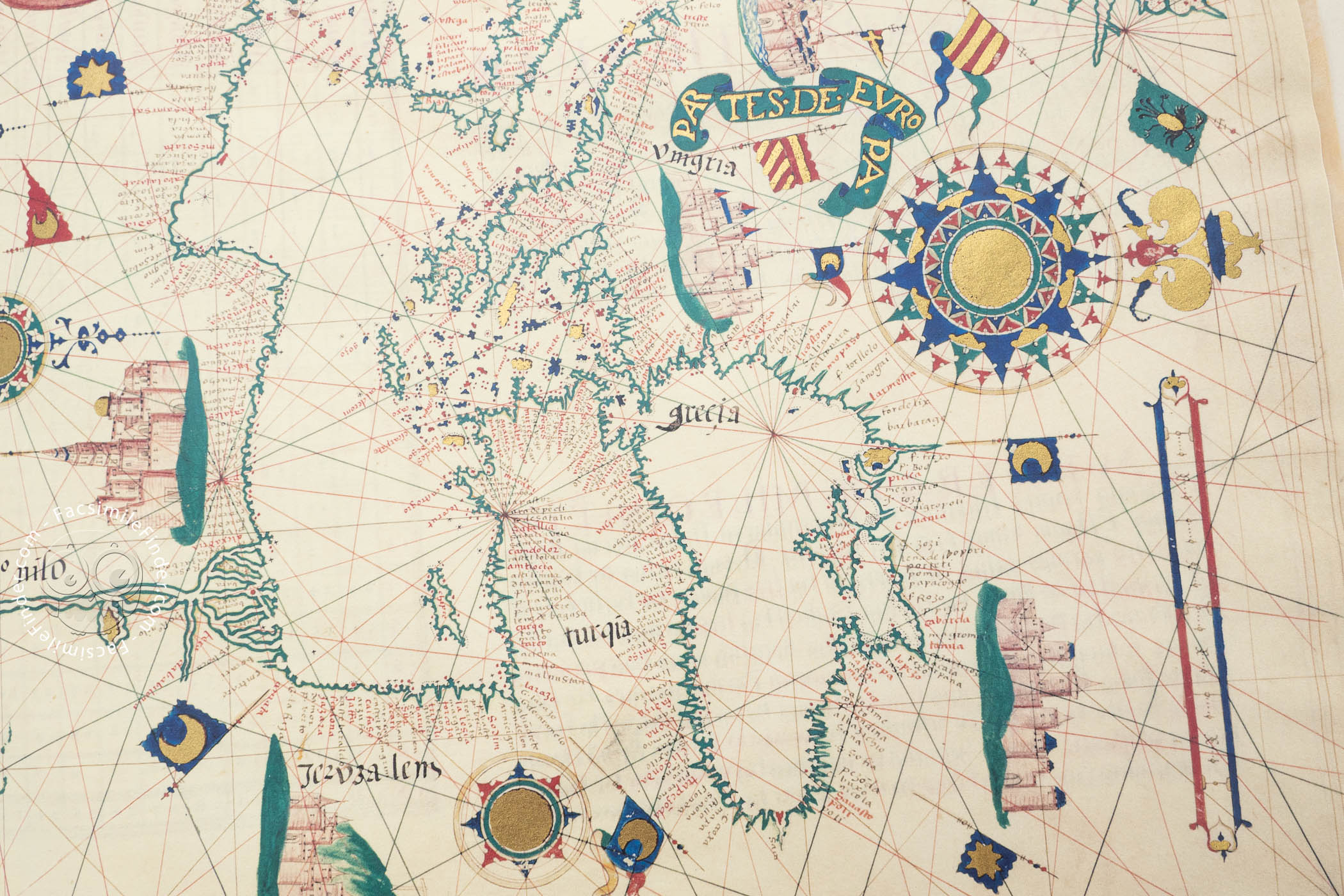
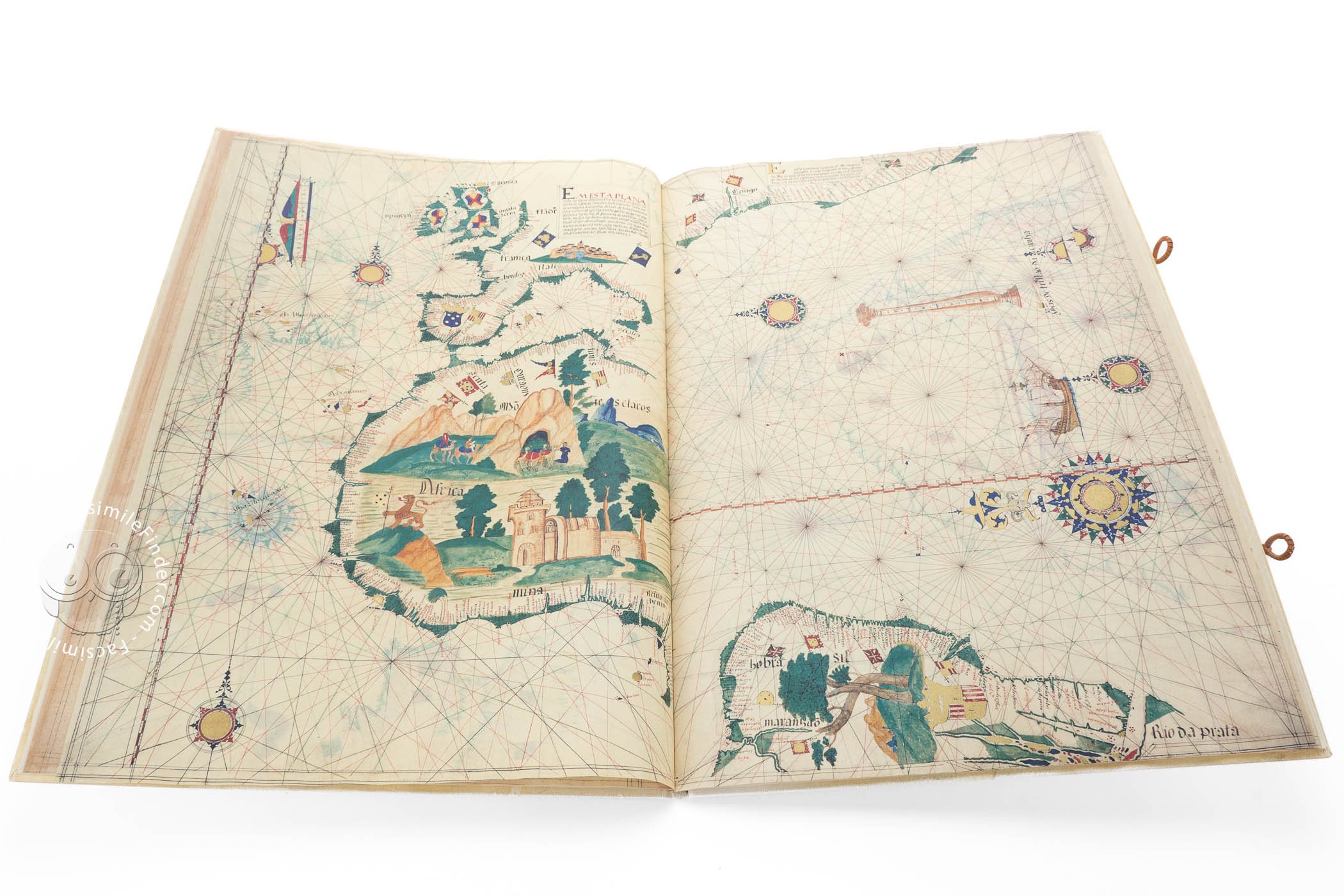
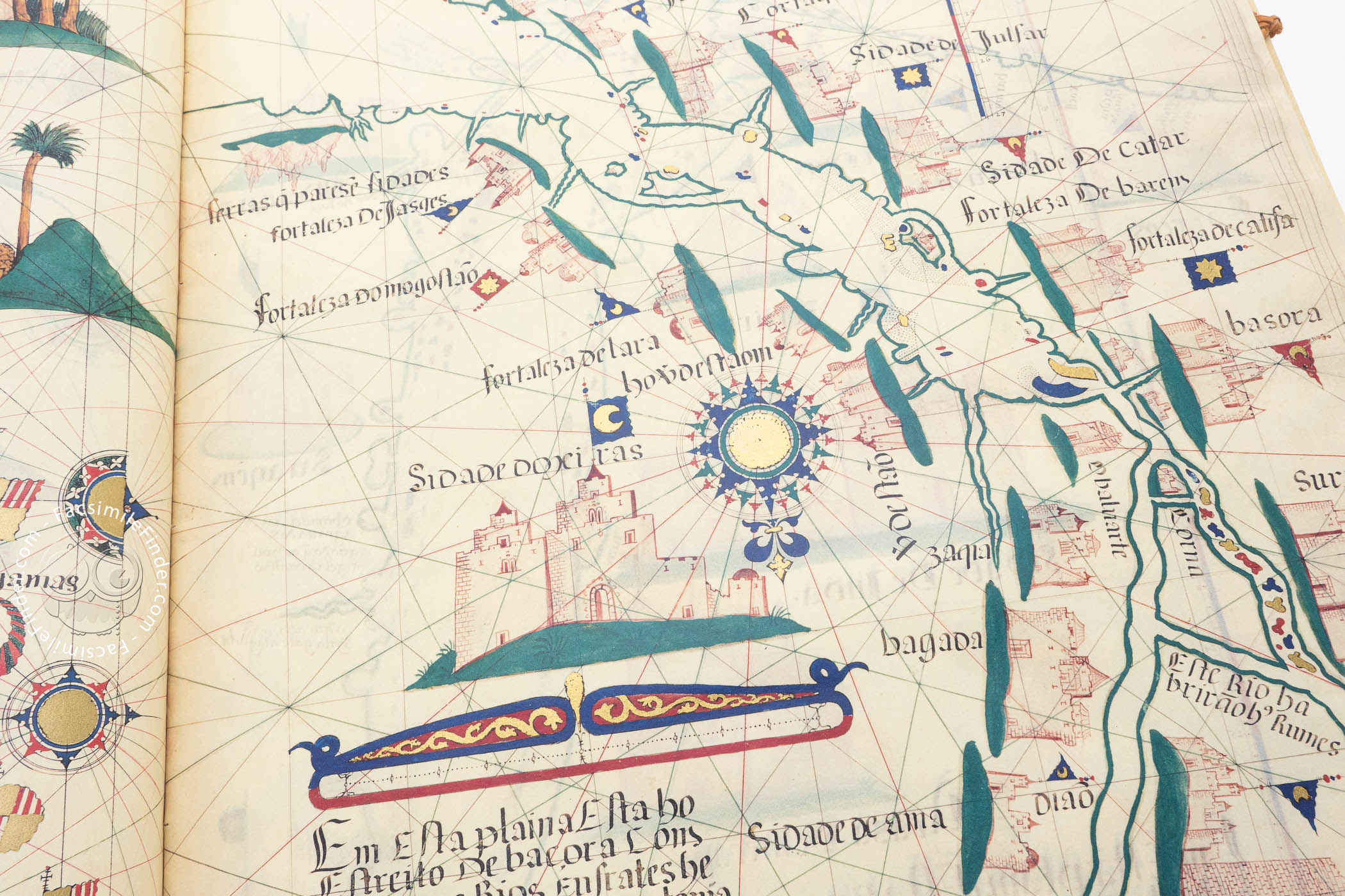
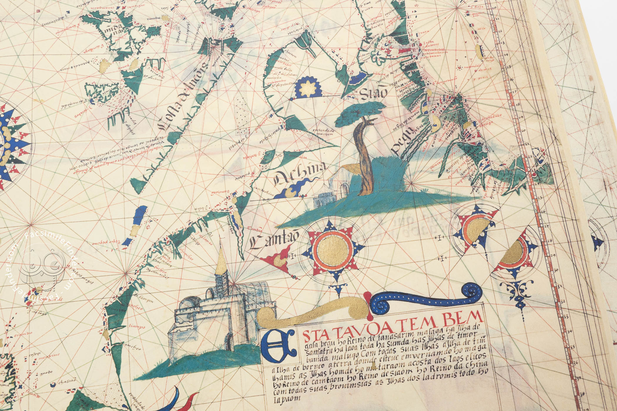
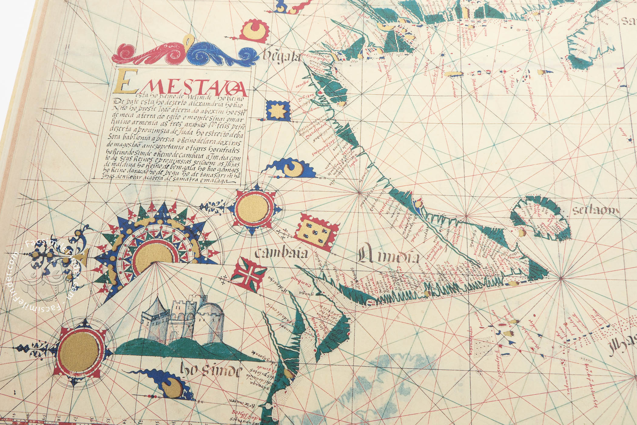
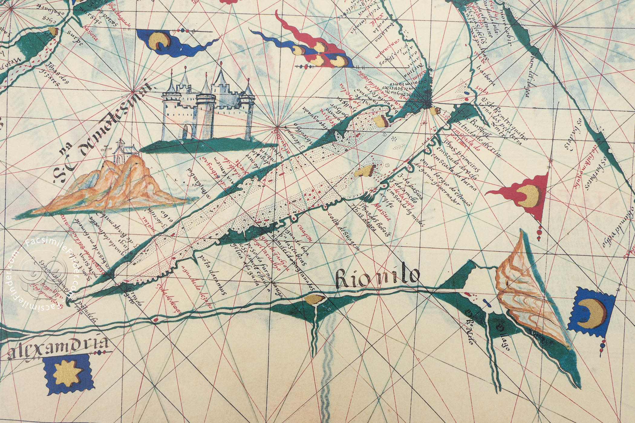
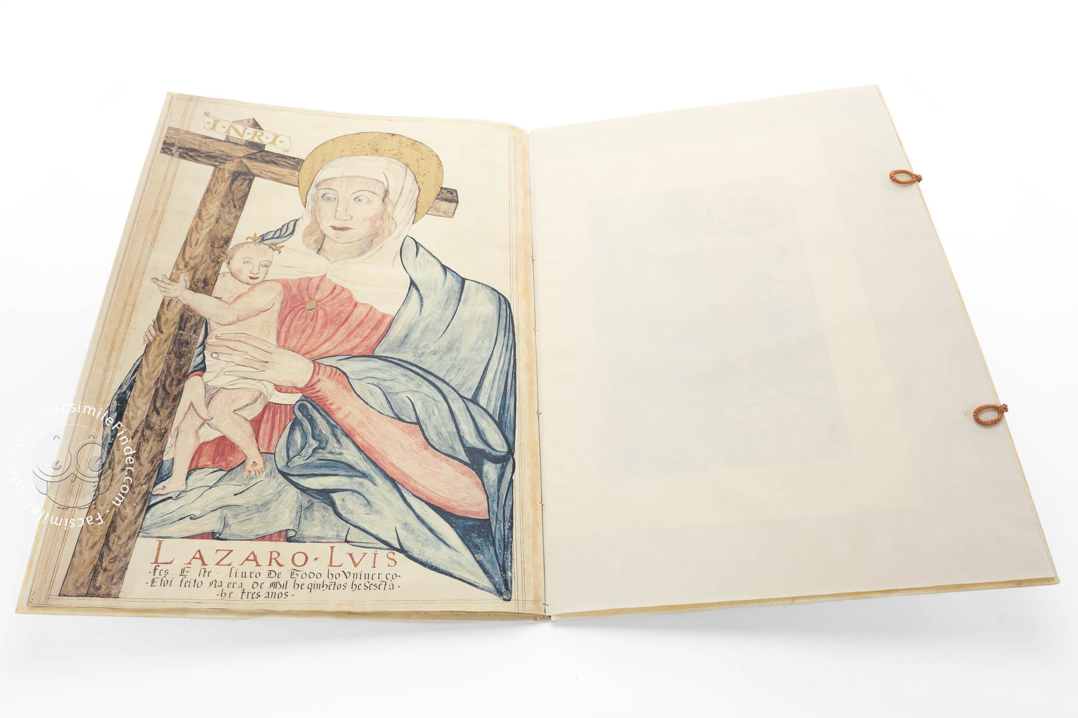
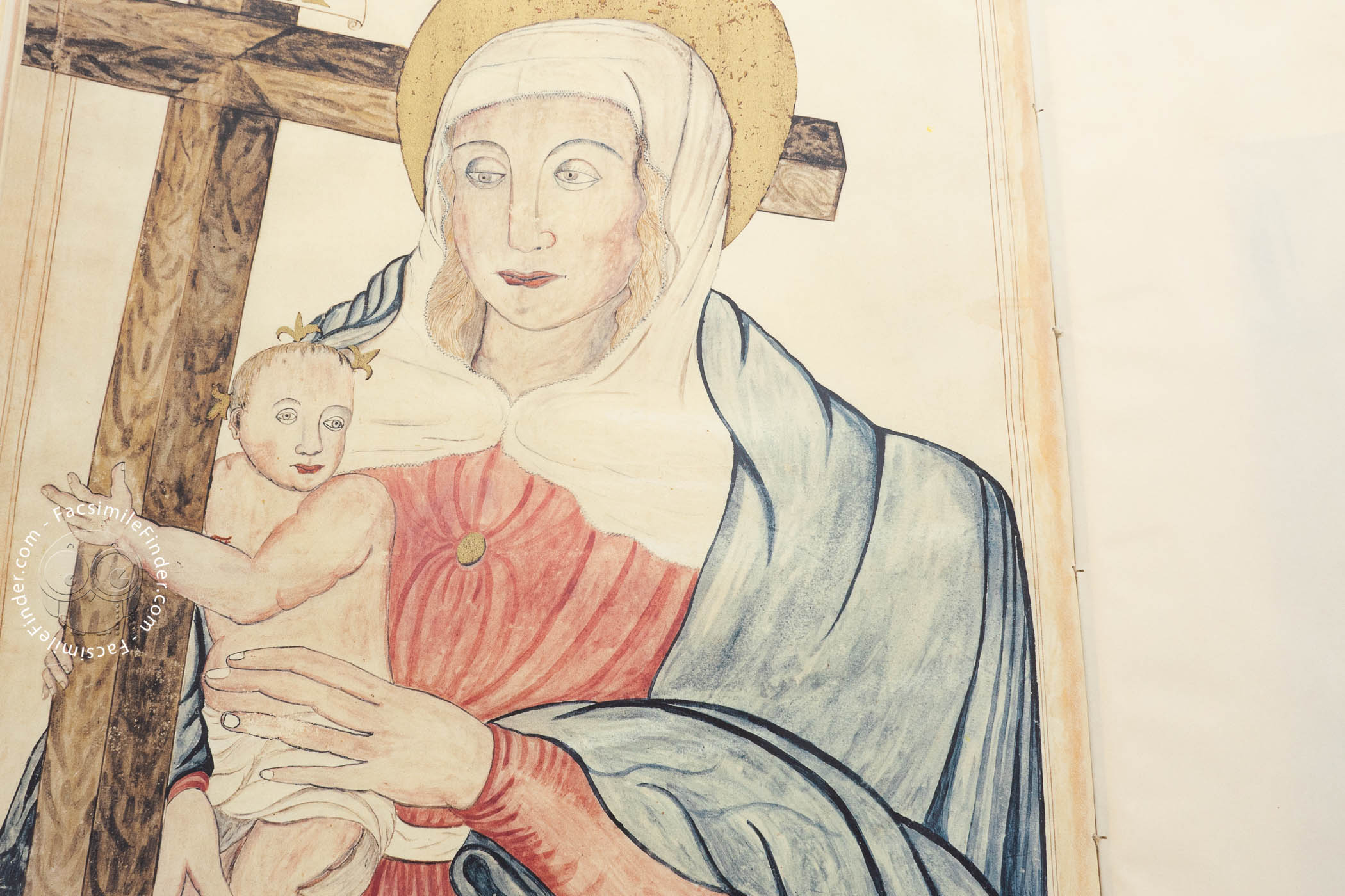
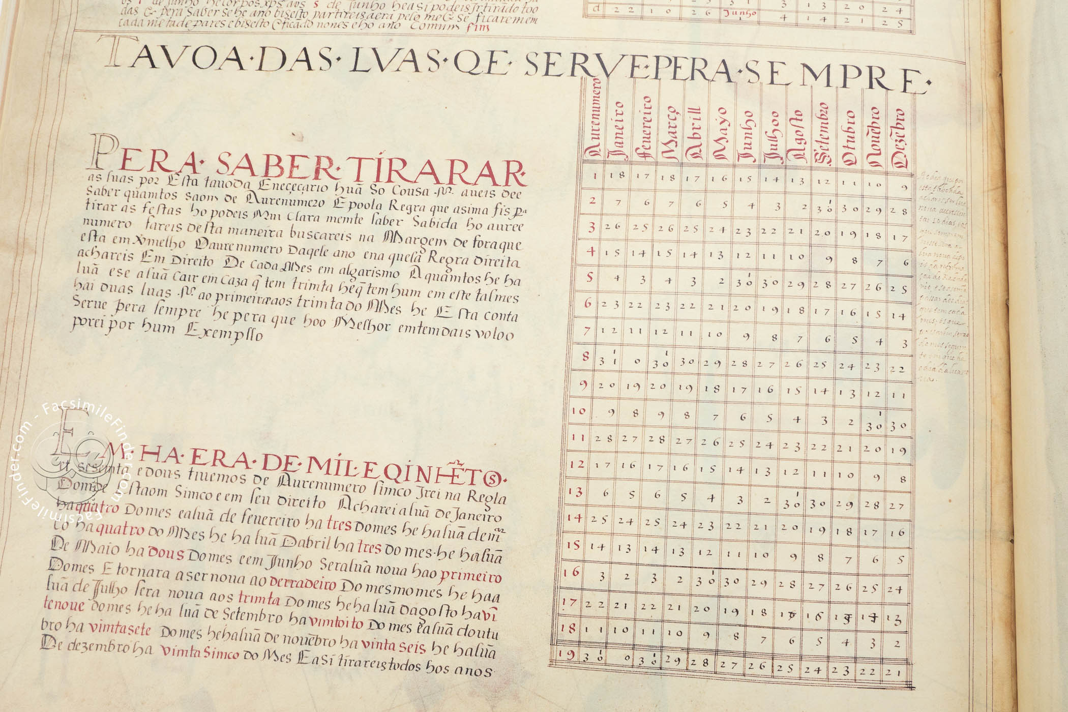
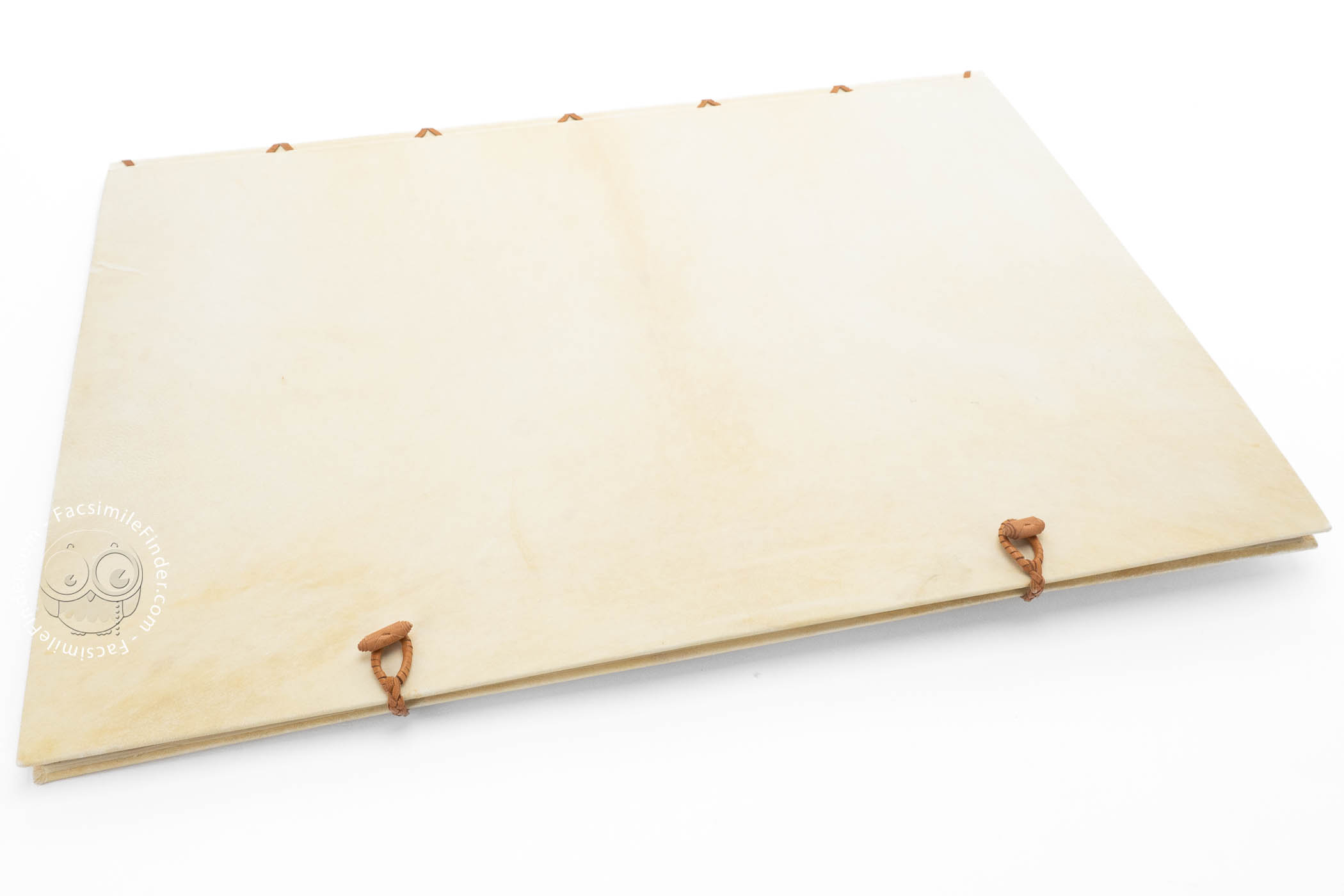

The Atlas of Lázaro Luís, produced in Portugal in 1563, is a large manuscript of maps depicting the four continents (Europe, Asia, Africa, and America) as they were known to Europeans at the time. Its author, Lázaro Luis, a cartographer and scientific illustrator, includes his name at the bottom of a full-page image of the Virgin and Child. The maps are richly decorated in color with gilded compass roses and headings, and vignettes of flora, fauna, cities, rivers, lakes, and other geographical features. The atlas includes star charts and number tables.
The Atlas was very popular in the 16th century. It can be considered a didactic manuscript due to its thorough representation of four continents (Europe, Asia, Africa, and America) as they were known until the mid-16th century.
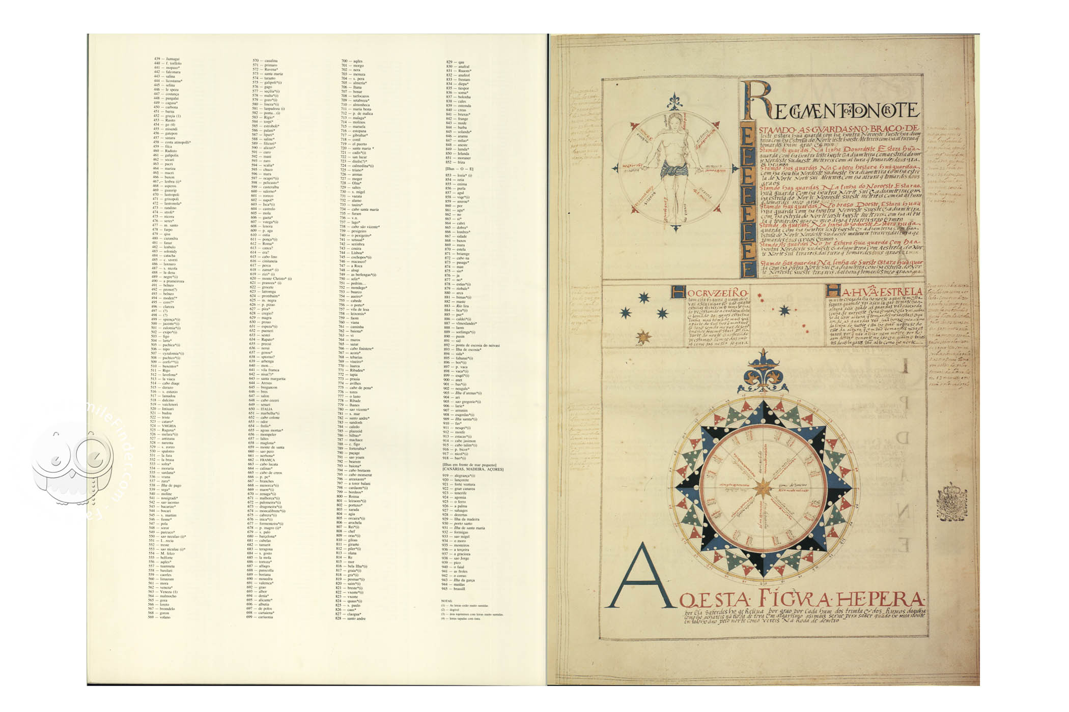
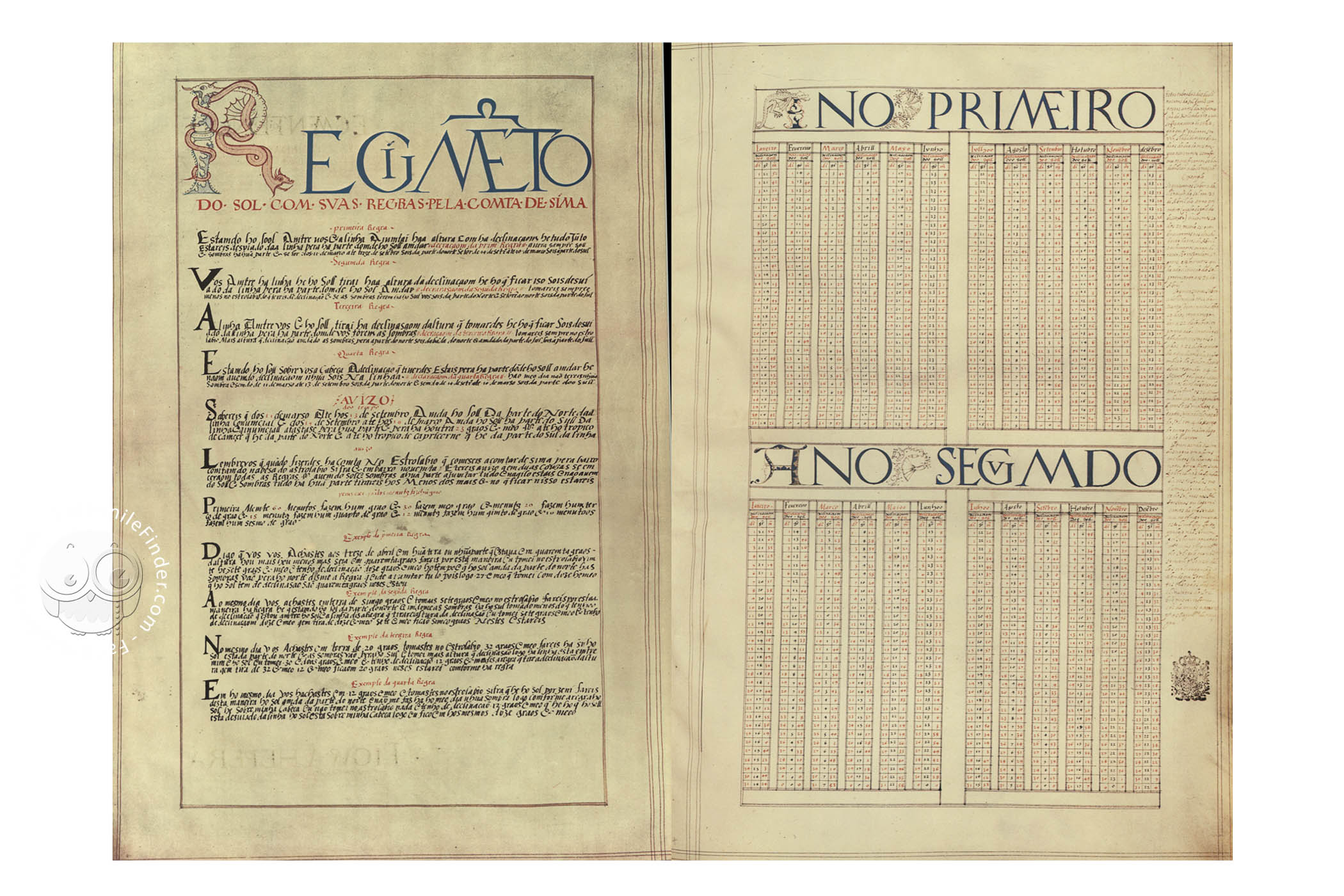
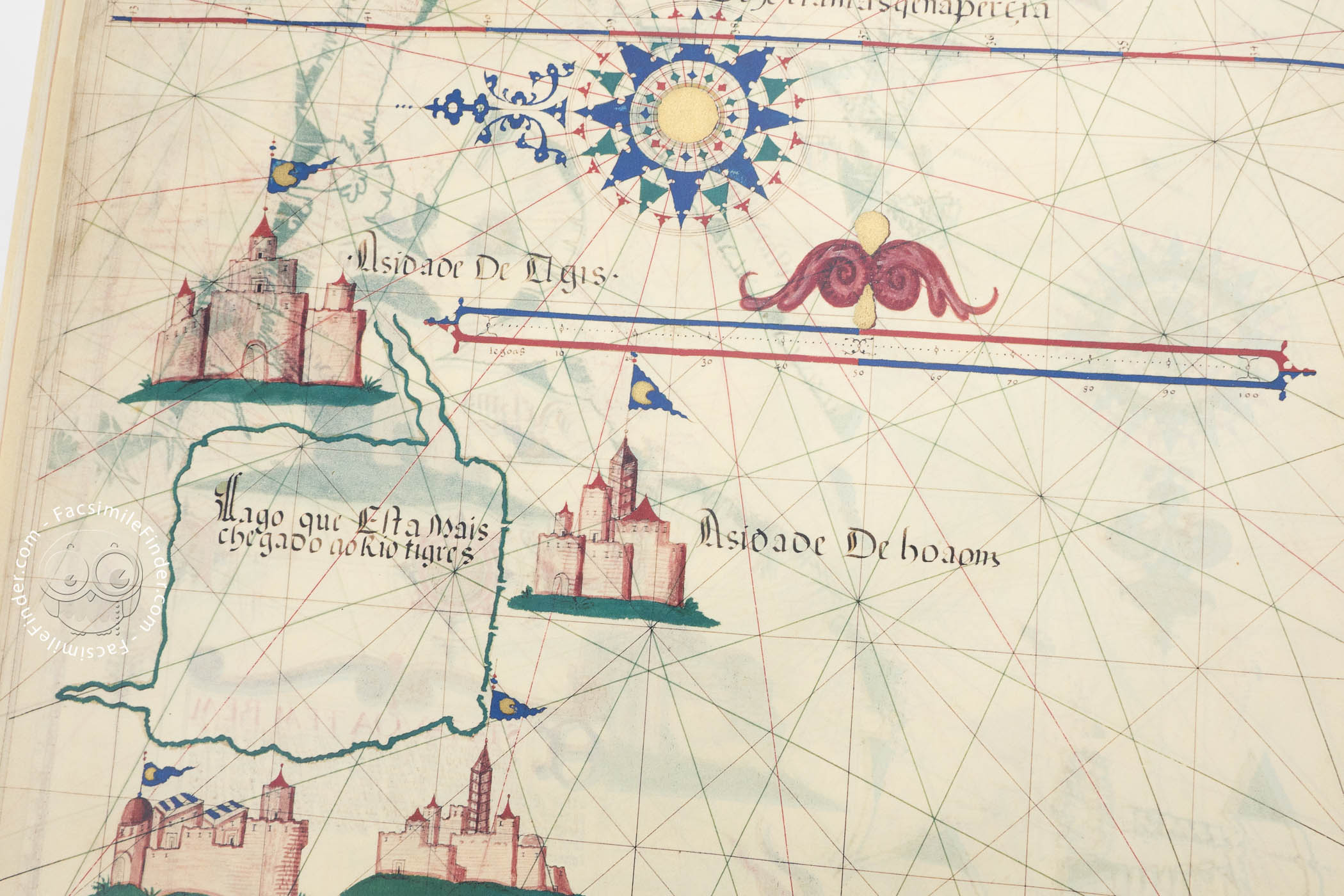
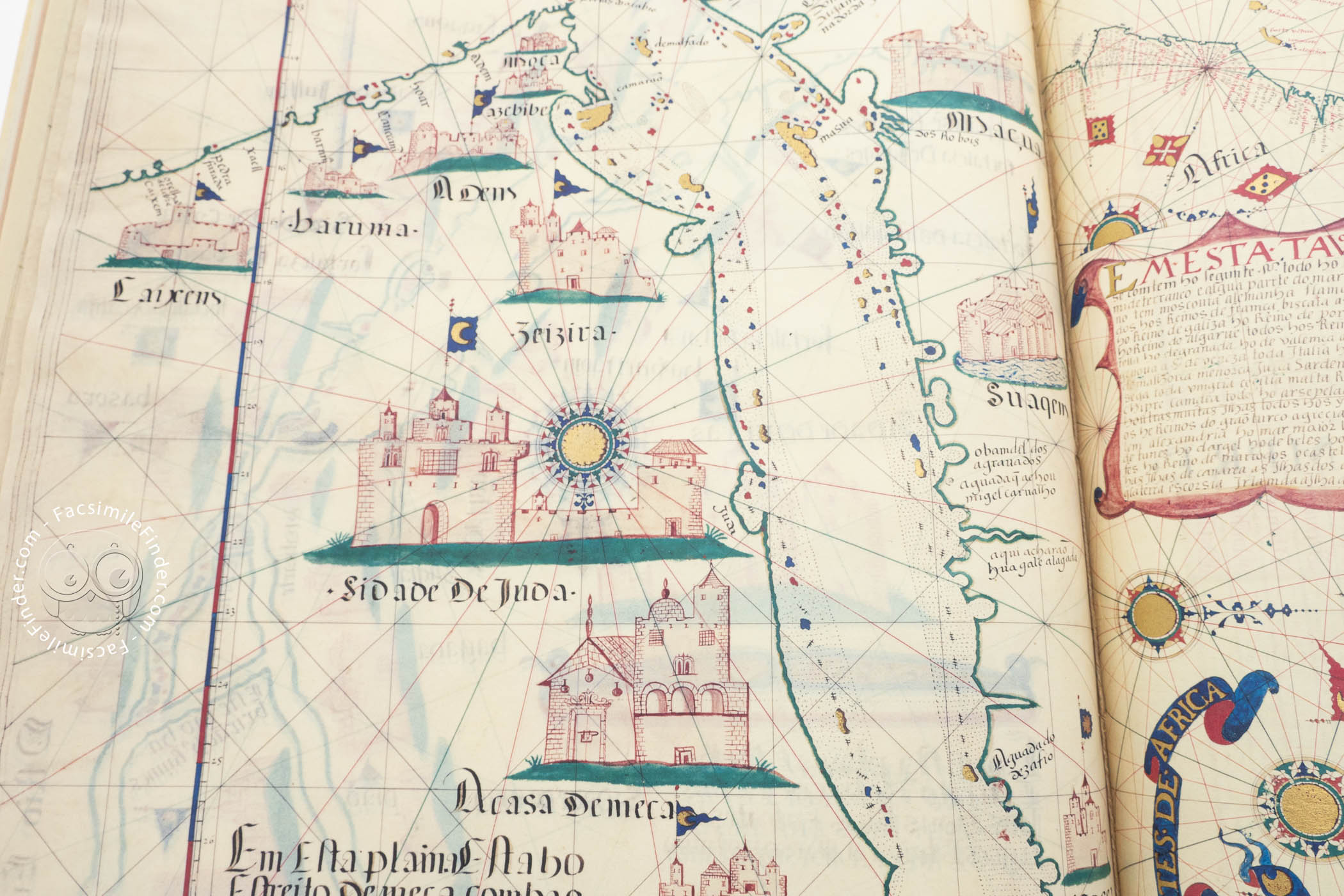
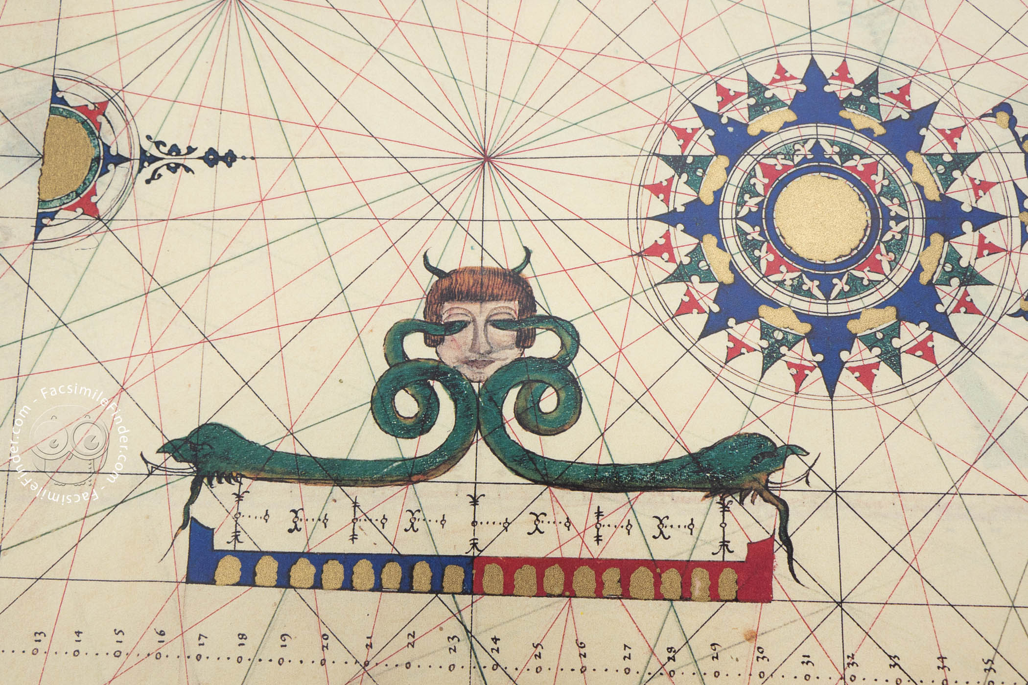
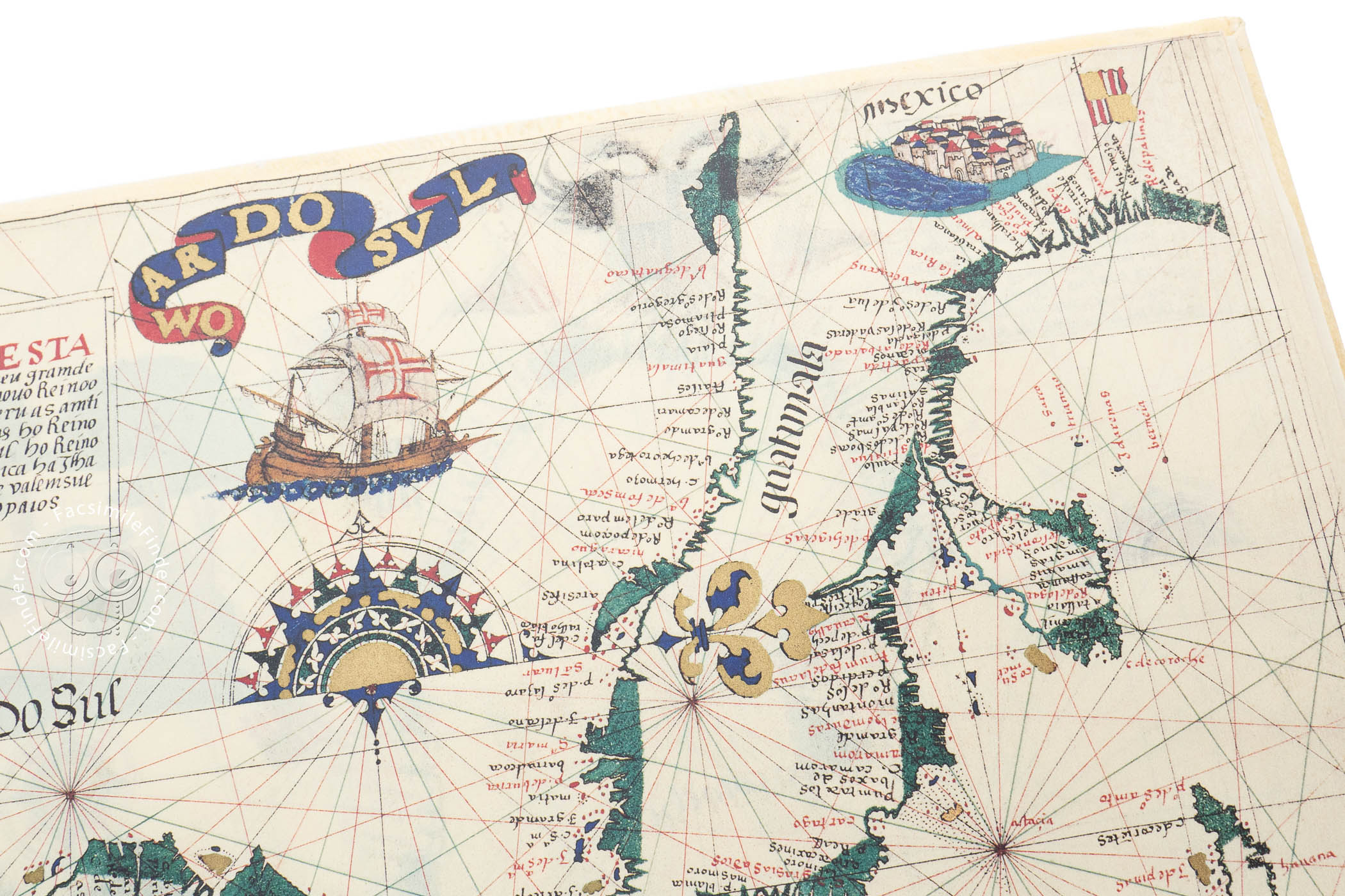
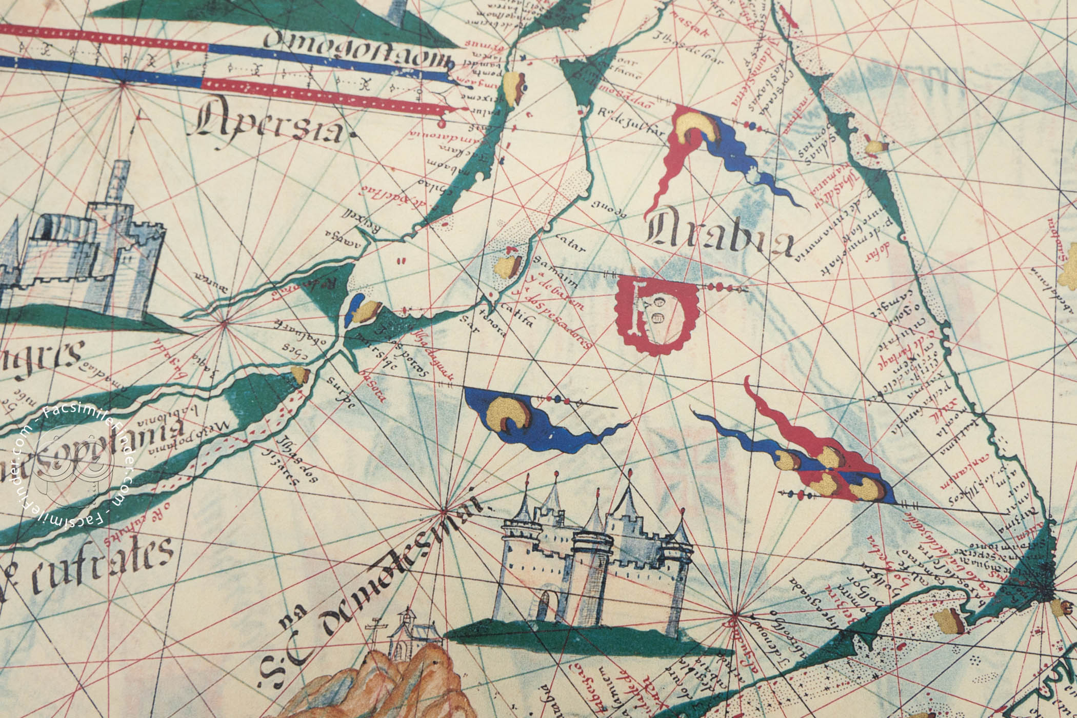
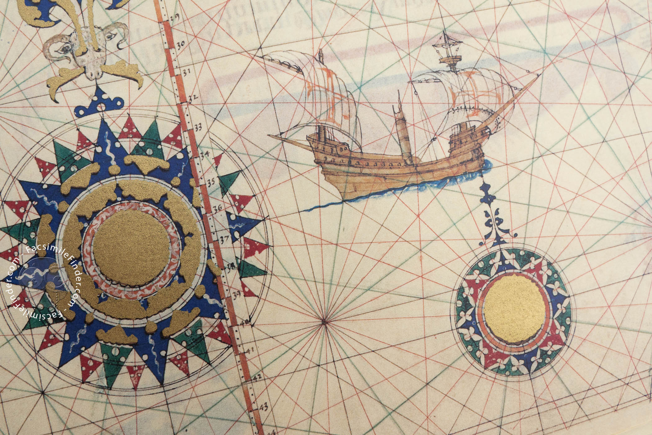
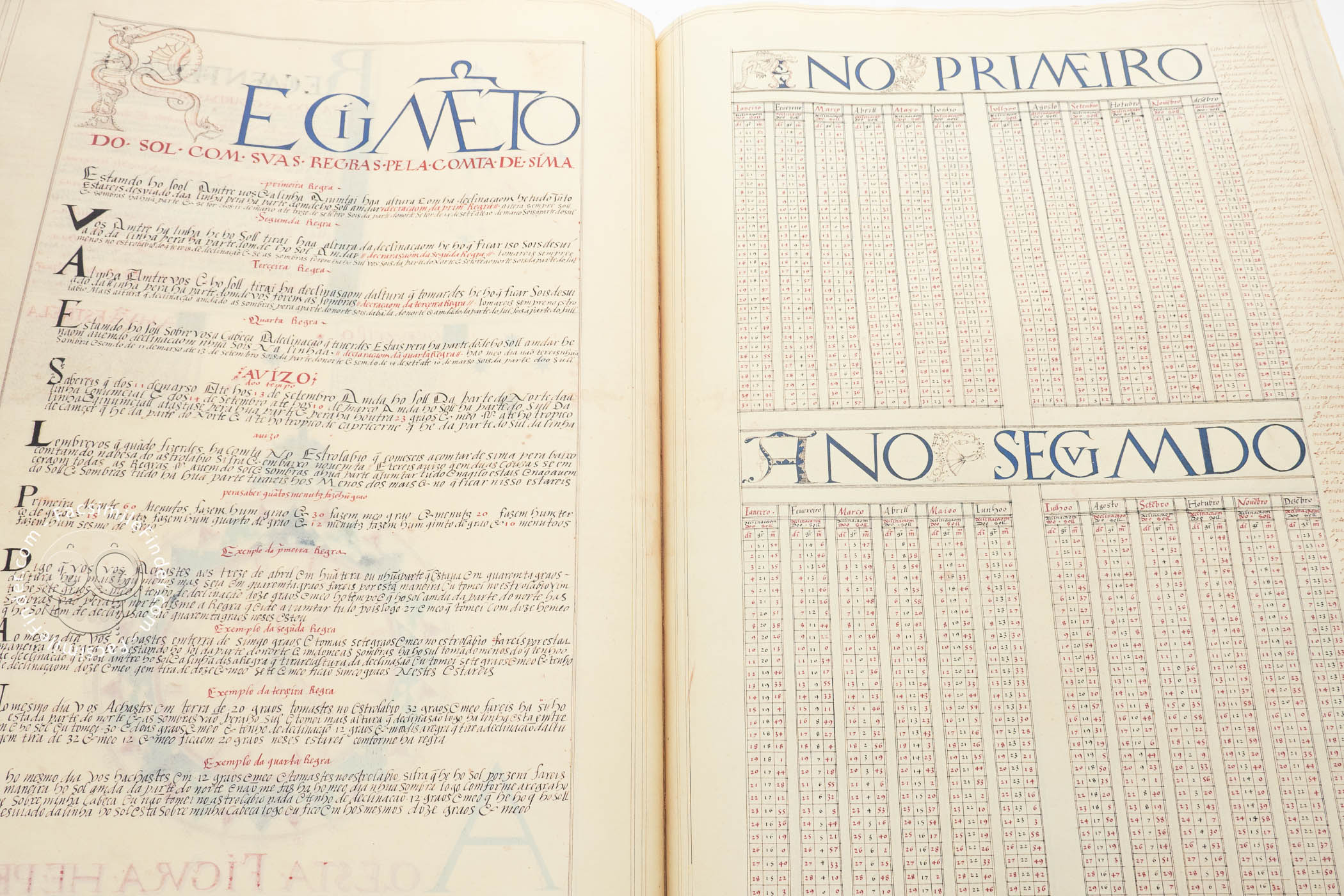
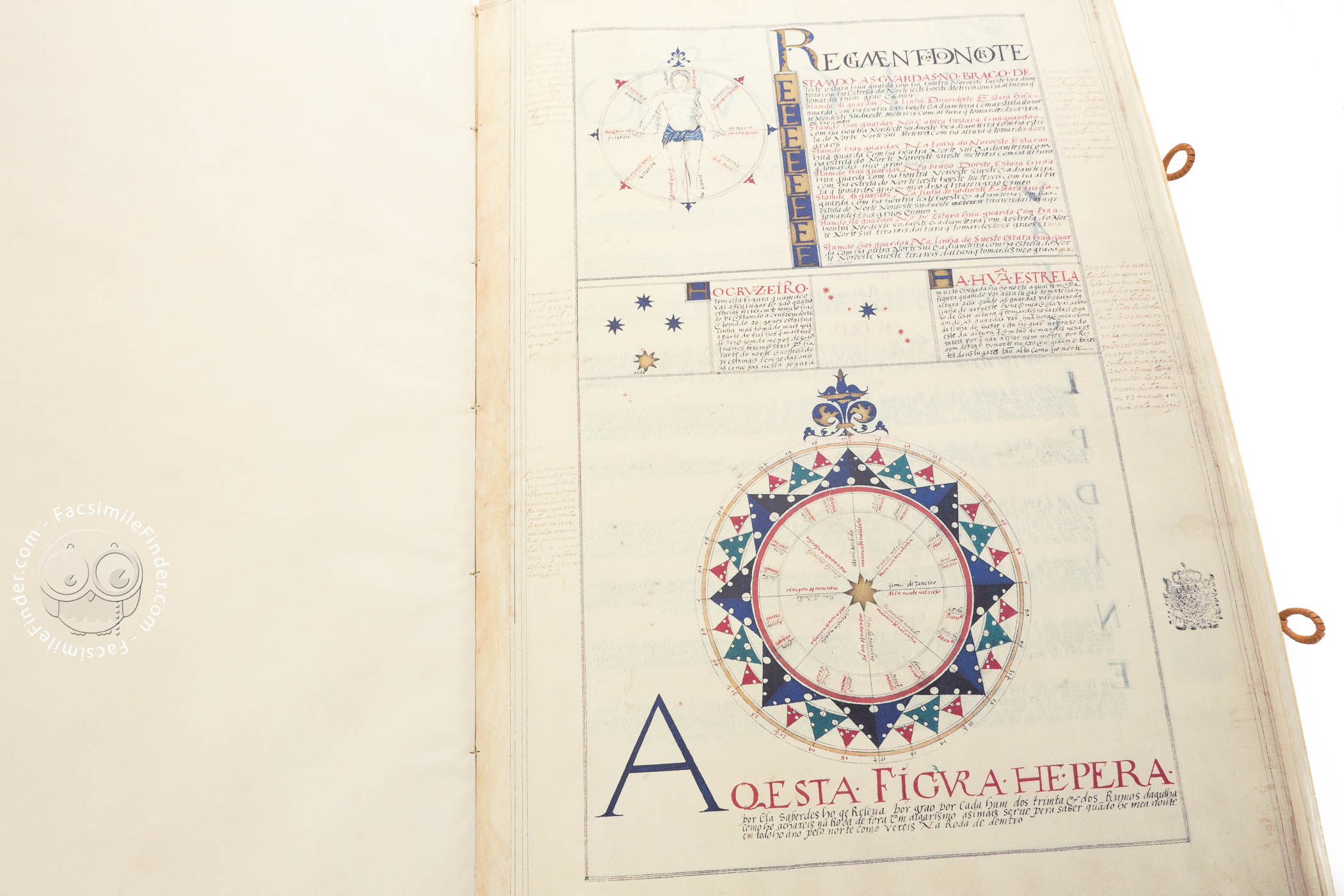
Drawing from the best Portuguese cartographic tradition, the Atlas is enriched with detailed illustrations of people (caravans in the Sahara desert), flora (equatorial vegetation in the Amazonian area), fluviology (the delta of the Plata and Nile rivers), mountains (the Andes), human settlements (indigenous villages in the Americas, cities such as Alexandria and Venice, holy cities such as Jerusalem), and heraldic symbols (flags, blazons, and crowns represented over the respective territories). Moreover, the first pages of the volume feature a beautiful star chart and a nautical regulation.
We have 1 facsimile edition of the manuscript "Atlas of Lázaro Luis": Atlas de Lázaro Luis facsimile edition, published by Xuntanza Editorial, 2006
Request Info / Price